Avèze geodata
Avèze (Occitanie) is a populated place; located in France in Europe/Paris (GMT+2) time zone. With population of 1,117 people, there are 8027 cities with bigger population in this country. Compared to other cities in France, 87.3% of cities are located further ↑North; 65.1% of cities are located further ←West and 76.2% of cities have lower elevation than Avèze. Note1
Administrative division(s):
- Level 1: Occitanie
- Level 2: Gard
- Level 3: Arrondissement du Vigan
- Level 4: Avèze


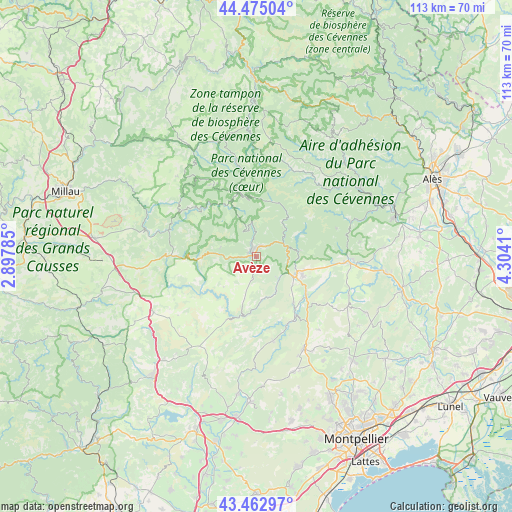
Avèze GPS coordinates[2]
43° 58' 16.176" North, 3° 36' 3.492" East
| Map corner | latitude | longitude |
|---|---|---|
| Upper-left | 44.47504°, | 2.89785° |
| Center: | 43.97116°, | 3.60097° |
| Lower-right: | 43.46297°, | 4.3041° |
| Map W x H: | 112.5×112.5 km | = 69.9×69.9mi |
| max Lat: | 51.07786° ⇑87.3% North |
| Avèze: | 43.97116° |
| min Lat: | ⇓12.7% South 41.3874° |
| min Long | Avèze | max Long |
| -5.08615° | 3.60097° | 9.52242° |
| W 65.1%⇐ | ⇒34.9% E |
Elevation
Elevation of Avèze is 258 m = 846 ft, and this is 64.3 m = 211 ft above average elevation for this country.
| Max E: |
2333 m = 7654 ft | 23.8% |
| Avèze | 258 m 846 ft | |
| Avg. | 193.7 m = 635 ft | |
Min E: |
-1 m = -3 ft | 76.2% |
See also: France elevation on elevation.city.
Geographical zone
Avèze is located in North temperate zone (between Tropic of Cancer and the Arctic Circle). Distance of this Northern Tropic circle is 2283.2 km =1418.7 mi to South.| Distance of | km | miles | from Avèze |
|---|---|---|---|
| North Pole | 5117.9 | 3180.1 | to North |
| Arctic Circle | 2512 | 1560.9 | to North |
| Tropic Cancer | 2283.2 | 1418.7 | to South |
| Equator | 4889.1 | 3037.9 | to South |


Nearby cities:
15 places around Avèze: (largest is in red/bold)
• Brissac
13.2 km =8.2 mi,  141°
141°
• Cazilhac
9.9 km =6.2 mi,  124°
124°
• Ganges
9.5 km =5.9 mi, 115°
• Laroque
11.2 km =7 mi, 118°
• Lasalle
21.9 km =13.6 mi,  67°
67°
• Le Vigan
2.4 km =1.5 mi,  8°
8°
• Molières-Cavaillac
2 km =1.2 mi,  283°
283°
• Pompignan
22.1 km =13.7 mi,  112°
112°
• Saint-André-de-Majencoules
8.7 km =5.4 mi,  43°
43°
• Saint-Bauzille-de-Putois
13.8 km =8.6 mi,  128°
128°
• Saint-Hippolyte-du-Fort
20.4 km =12.7 mi,  92°
92°
• Saint-Jean-du-Bruel
20 km =12.4 mi,  286°
286°
• Saint-Martin-de-Londres
22.6 km =14 mi,  152°
152°
• Sumène
9.2 km =5.7 mi,  83°
83°
• Valleraugue
12.7 km =7.9 mi, 14°
Sources, notices
• [Note1] Compared only with cities in France existing in our database
• [Src1] Map data: © OpenStreetMap contributors (CC-BY-SA)
• [Src2] Other city data from geonames.org with taken over terms of usage.
• [Src3] Geographical zone / Annual Mean Temperature by Robert A. Rohde @ Wikipedia
