Aubigné-Racan geodata
Aubigné-Racan (Pays de la Loire) is a populated place; located in France in Europe/Paris (GMT+2) time zone. With population of 2,211 people, there are 4348 cities with bigger population in this country. Compared to other cities in France, 54.1% of cities are located further ↓South; 75.6% of cities are located further →East and 78.2% of cities have higher elevation than Aubigné-Racan. Note1
Administrative division(s):
- Level 1: Pays de la Loire
- Level 2: Sarthe
- Level 3: Arrondissement de La Flèche
- Level 4: Aubigné-Racan


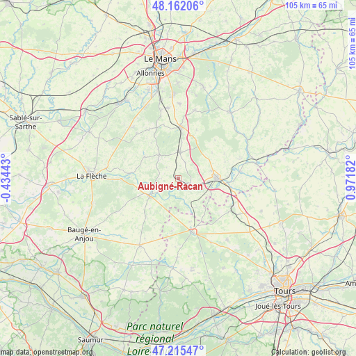
Aubigné-Racan GPS coordinates[2]
47° 41' 27.276" North, 0° 16' 7.32" East
| Map corner | latitude | longitude |
|---|---|---|
| Upper-left | 48.16206°, | -0.43443° |
| Center: | 47.69091°, | 0.2687° |
| Lower-right: | 47.21547°, | 0.97182° |
| Map W x H: | 105.3×105.2 km | = 65.4×65.4mi |
| max Lat: | 51.07786° ⇑45.9% North |
| Aubigné-Racan: | 47.69091° |
| min Lat: | ⇓54.1% South 41.3874° |
| min Long | Aubigné-Racan | max Long |
| -5.08615° | 0.2687° | 9.52242° |
| W 24.4%⇐ | ⇒75.6% E |
Elevation
Elevation of Aubigné-Racan is 59 m = 194 ft, and this is 134.7 m = 442 ft below average elevation for this country.
| Max E: |
2333 m = 7654 ft | 78.2% |
| Avg. | 193.7 m = 635 ft | |
| Aubigné-Racan | 59 m = 194 ft | |
Min E: |
-1 m = -3 ft | 21.8% |
See also: France elevation on elevation.city.
Geographical zone
Aubigné-Racan is located in North temperate zone (between Tropic of Cancer and the Arctic Circle). Distance of this North polar circle is 2098.4 km =1303.9 mi to North.| Distance of | km | miles | from Aubigné-Racan |
|---|---|---|---|
| North Pole | 4704.3 | 2923.1 | to North |
| Arctic Circle | 2098.4 | 1303.9 | to North |
| Tropic Cancer | 2696.8 | 1675.7 | to South |
| Equator | 5302.7 | 3294.9 | to South |


Nearby cities:
15 places around Aubigné-Racan: (largest is in red/bold)
• Château-du-Loir
11.2 km =7 mi,  87°
87°
• Coulongé
5 km =3.1 mi,  267°
267°
• Dissé-sous-le-Lude
12.4 km =7.7 mi,  223°
223°
• Flée
14.6 km =9.1 mi,  71°
71°
• Le Lude
9.7 km =6 mi,  239°
239°
• Luceau
9.9 km =6.2 mi,  76°
76°
• Luché-Pringé
14.5 km =9 mi,  275°
275°
• Mansigné
12 km =7.5 mi,  302°
302°
• Mayet
7.7 km =4.8 mi,  3°
3°
• Montabon
8.7 km =5.4 mi,  95°
95°
• Pontvallain
8.9 km =5.5 mi,  319°
319°
• Requeil
13.1 km =8.1 mi, 322°
• Vaas
4.4 km =2.7 mi,  124°
124°
• Verneil-le-Chétif
5.1 km =3.2 mi,  23°
23°
• Villiers-au-Bouin
13.4 km =8.3 mi,  165°
165°
Sources, notices
• [Note1] Compared only with cities in France existing in our database
• [Src1] Map data: © OpenStreetMap contributors (CC-BY-SA)
• [Src2] Other city data from geonames.org with taken over terms of usage.
• [Src3] Geographical zone / Annual Mean Temperature by Robert A. Rohde @ Wikipedia
