Mazamet geodata
Mazamet (Occitanie) is a populated place; located in France in Europe/Paris (GMT+2) time zone. With population of 11,479 people, there are 842 cities with bigger population in this country. Compared to other cities in France, 93.2% of cities are located further ↑North; 51.5% of cities are located further →East and 76.4% of cities have lower elevation than Mazamet. Note1
Administrative division(s):
- Level 1: Occitanie
- Level 2: Tarn
- Level 3: Arrondissement de Castres
- Level 4: Mazamet


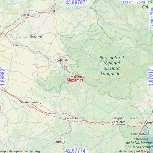
Mazamet GPS coordinates[2]
43° 29' 24.036" North, 2° 22' 22.944" East
| Map corner | latitude | longitude |
|---|---|---|
| Upper-left | 43.99797°, | 1.66992° |
| Center: | 43.49001°, | 2.37304° |
| Lower-right: | 42.97774°, | 3.07617° |
| Map W x H: | 113.4×113.4 km | = 70.5×70.5mi |
| max Lat: | 51.07786° ⇑93.2% North |
| Mazamet: | 43.49001° |
| min Lat: | ⇓6.8% South 41.3874° |
| min Long | Mazamet | max Long |
| -5.08615° | 2.37304° | 9.52242° |
| W 48.5%⇐ | ⇒51.5% E |
Elevation
Elevation of Mazamet is 259 m = 850 ft, and this is 65.3 m = 214 ft above average elevation for this country.
| Max E: |
2333 m = 7654 ft | 23.6% |
| Mazamet | 259 m 850 ft | |
| Avg. | 193.7 m = 635 ft | |
Min E: |
-1 m = -3 ft | 76.4% |
See also: France elevation on elevation.city.
Geographical zone
Mazamet is located in North temperate zone (between Tropic of Cancer and the Arctic Circle). Distance of this Northern Tropic circle is 2229.7 km =1385.5 mi to South.| Distance of | km | miles | from Mazamet |
|---|---|---|---|
| North Pole | 5171.4 | 3213.4 | to North |
| Arctic Circle | 2565.5 | 1594.1 | to North |
| Tropic Cancer | 2229.7 | 1385.5 | to South |
| Equator | 4835.6 | 3004.7 | to South |


Nearby cities:
15 places around Mazamet: (largest is in red/bold)
• Aiguefonde
4.6 km =2.9 mi,  275°
275°
• Albine
13.9 km =8.6 mi,  104°
104°
• Aussillon
1.5 km =0.9 mi,  343°
343°
• Bout-du-Pont-de-Larn
3.6 km =2.2 mi,  76°
76°
• Escoussens
12.9 km =8 mi, 275°
• Labruguière
10.3 km =6.4 mi,  301°
301°
• Lagarrigue
12.4 km =7.7 mi,  321°
321°
• Noailhac
9.4 km =5.8 mi,  350°
350°
• Payrin-Augmontel
6.2 km =3.9 mi, 345°
• Pont-de-Larn
3.2 km =2 mi,  60°
60°
• Saint-Affrique-les-Montagnes
14.4 km =8.9 mi,  291°
291°
• Saint-Amans-Soult
9.6 km =6 mi, 98°
• Saint-Amans-Valtoret
9.6 km =6 mi, 96°
• Saint-Salvy-de-la-Balme
13.7 km =8.5 mi,  8°
8°
• Valdurenque
10.3 km =6.4 mi,  328°
328°
Sources, notices
• [Note1] Compared only with cities in France existing in our database
• [Src1] Map data: © OpenStreetMap contributors (CC-BY-SA)
• [Src2] Other city data from geonames.org with taken over terms of usage.
• [Src3] Geographical zone / Annual Mean Temperature by Robert A. Rohde @ Wikipedia
