Payrin-Augmontel geodata
Payrin-Augmontel (Occitanie) is a populated place; located in France in Europe/Paris (GMT+2) time zone. With population of 2,123 people, there are 4536 cities with bigger population in this country. Compared to other cities in France, 92.5% of cities are located further ↑North; 51.8% of cities are located further →East and 84.4% of cities have lower elevation than Payrin-Augmontel. Note1
Administrative division(s):
- Level 1: Occitanie
- Level 2: Tarn
- Level 3: Arrondissement de Castres
- Level 4: Payrin-Augmontel


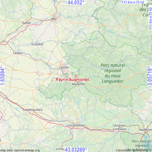
Payrin-Augmontel GPS coordinates[2]
43° 32' 40.2" North, 2° 21' 14.616" East
| Map corner | latitude | longitude |
|---|---|---|
| Upper-left | 44.052°, | 1.65094° |
| Center: | 43.5445°, | 2.35406° |
| Lower-right: | 43.03269°, | 3.05719° |
| Map W x H: | 113.3×113.3 km | = 70.4×70.4mi |
| max Lat: | 51.07786° ⇑92.5% North |
| Payrin-Augmontel: | 43.5445° |
| min Lat: | ⇓7.5% South 41.3874° |
| min Long | Payrin-Augmonte | max Long |
| -5.08615° | 2.35406° | 9.52242° |
| W 48.2%⇐ | ⇒51.8% E |
Elevation
Elevation of Payrin-Augmontel is 340 m = 1115 ft, and this is 146.3 m = 480 ft above average elevation for this country.
| Max E: |
2333 m = 7654 ft | 15.6% |
| Payrin-Augmontel | 340 m 1115 ft | |
| Avg. | 193.7 m = 635 ft | |
Min E: |
-1 m = -3 ft | 84.4% |
See also: France elevation on elevation.city.
Geographical zone
Payrin-Augmontel is located in North temperate zone (between Tropic of Cancer and the Arctic Circle). Distance of this Northern Tropic circle is 2235.8 km =1389.3 mi to South.| Distance of | km | miles | from Payrin-Augmontel |
|---|---|---|---|
| North Pole | 5165.4 | 3209.6 | to North |
| Arctic Circle | 2559.5 | 1590.4 | to North |
| Tropic Cancer | 2235.8 | 1389.3 | to South |
| Equator | 4841.7 | 3008.5 | to South |


Nearby cities:
15 places around Payrin-Augmontel: (largest is in red/bold)
• Aiguefonde
6.4 km =4 mi,  208°
208°
• Aussillon
4.8 km =3 mi,  166°
166°
• Bout-du-Pont-de-Larn
7.3 km =4.5 mi,  136°
136°
• Burlats
10.6 km =6.6 mi,  344°
344°
• Castres
11.5 km =7.1 mi,  306°
306°
• Labruguière
7.3 km =4.5 mi,  264°
264°
• Lagarrigue
7.2 km =4.5 mi,  300°
300°
• Le Bez
11.9 km =7.4 mi,  55°
55°
• Mazamet
6.2 km =3.9 mi, 165°
• Navès
10.6 km =6.6 mi,  282°
282°
• Noailhac
3.2 km =2 mi,  359°
359°
• Pont-de-Larn
6.2 km =3.9 mi, 135°
• Saint-Affrique-les-Montagnes
11.9 km =7.4 mi,  266°
266°
• Saint-Salvy-de-la-Balme
8.3 km =5.2 mi,  25°
25°
• Valdurenque
4.7 km =2.9 mi, 306°
Sources, notices
• [Note1] Compared only with cities in France existing in our database
• [Src1] Map data: © OpenStreetMap contributors (CC-BY-SA)
• [Src2] Other city data from geonames.org with taken over terms of usage.
• [Src3] Geographical zone / Annual Mean Temperature by Robert A. Rohde @ Wikipedia
