Aiguefonde geodata
Aiguefonde (Occitanie) is a populated place; located in France in Europe/Paris (GMT+2) time zone. With population of 2,786 people, there are 3509 cities with bigger population in this country. Compared to other cities in France, 93.1% of cities are located further ↑North; 52.4% of cities are located further →East and 84.9% of cities have lower elevation than Aiguefonde. Note1
Administrative division(s):
- Level 1: Occitanie
- Level 2: Tarn
- Level 3: Arrondissement de Castres
- Level 4: Aiguefonde


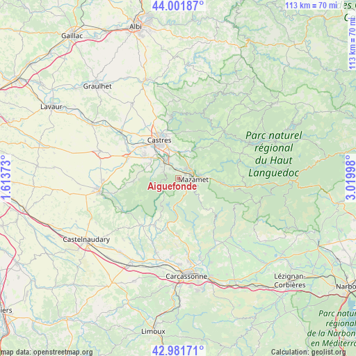
Aiguefonde GPS coordinates[2]
43° 29' 38.184" North, 2° 19' 0.696" East
| Map corner | latitude | longitude |
|---|---|---|
| Upper-left | 44.00187°, | 1.61373° |
| Center: | 43.49394°, | 2.31686° |
| Lower-right: | 42.98171°, | 3.01998° |
| Map W x H: | 113.4×113.4 km | = 70.5×70.5mi |
| max Lat: | 51.07786° ⇑93.1% North |
| Aiguefonde: | 43.49394° |
| min Lat: | ⇓6.9% South 41.3874° |
| min Long | Aiguefonde | max Long |
| -5.08615° | 2.31686° | 9.52242° |
| W 47.6%⇐ | ⇒52.4% E |
Elevation
Elevation of Aiguefonde is 345 m = 1132 ft, and this is 151.3 m = 496 ft above average elevation for this country.
| Max E: |
2333 m = 7654 ft | 15.1% |
| Aiguefonde | 345 m 1132 ft | |
| Avg. | 193.7 m = 635 ft | |
Min E: |
-1 m = -3 ft | 84.9% |
See also: France elevation on elevation.city.
Geographical zone
Aiguefonde is located in North temperate zone (between Tropic of Cancer and the Arctic Circle). Distance of this Northern Tropic circle is 2230.2 km =1385.8 mi to South.| Distance of | km | miles | from Aiguefonde |
|---|---|---|---|
| North Pole | 5171 | 3213.1 | to North |
| Arctic Circle | 2565.1 | 1593.9 | to North |
| Tropic Cancer | 2230.2 | 1385.8 | to South |
| Equator | 4836.1 | 3005 | to South |


Nearby cities:
15 places around Aiguefonde: (largest is in red/bold)
• Aussillon
4.2 km =2.6 mi,  76°
76°
• Bout-du-Pont-de-Larn
8 km =5 mi,  87°
87°
• Cuxac-Cabardès
13.9 km =8.6 mi,  191°
191°
• Escoussens
8.3 km =5.2 mi,  274°
274°
• Labruguière
6.5 km =4 mi,  319°
319°
• Lagarrigue
9.8 km =6.1 mi,  341°
341°
• Mazamet
4.6 km =2.9 mi,  95°
95°
• Navès
10.8 km =6.7 mi, 317°
• Noailhac
9.3 km =5.8 mi,  18°
18°
• Payrin-Augmontel
6.4 km =4 mi,  28°
28°
• Pont-de-Larn
7.4 km =4.6 mi, 81°
• Saint-Affrique-les-Montagnes
10.1 km =6.3 mi,  298°
298°
• Valdurenque
8.5 km =5.3 mi,  354°
354°
• Verdalle
12.8 km =8 mi,  278°
278°
• Viviers-lès-Montagnes
13.2 km =8.2 mi, 300°
Sources, notices
• [Note1] Compared only with cities in France existing in our database
• [Src1] Map data: © OpenStreetMap contributors (CC-BY-SA)
• [Src2] Other city data from geonames.org with taken over terms of usage.
• [Src3] Geographical zone / Annual Mean Temperature by Robert A. Rohde @ Wikipedia
