Lagarrigue geodata
Lagarrigue (Occitanie) is a populated place; located in France in Europe/Paris (GMT+2) time zone. With population of 1,749 people, there are 5416 cities with bigger population in this country. Compared to other cities in France, 92.1% of cities are located further ↑North; 53.1% of cities are located further →East and 67.8% of cities have lower elevation than Lagarrigue. Note1
Administrative division(s):
- Level 1: Occitanie
- Level 2: Tarn
- Level 3: Arrondissement de Castres
- Level 4: Lagarrigue


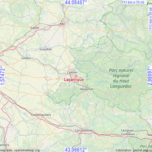
Lagarrigue GPS coordinates[2]
43° 34' 39.54" North, 2° 16' 40.224" East
| Map corner | latitude | longitude |
|---|---|---|
| Upper-left | 44.08487°, | 1.57472° |
| Center: | 43.57765°, | 2.27784° |
| Lower-right: | 43.06612°, | 2.98097° |
| Map W x H: | 113.3×113.3 km | = 70.4×70.4mi |
| max Lat: | 51.07786° ⇑92.1% North |
| Lagarrigue: | 43.57765° |
| min Lat: | ⇓7.9% South 41.3874° |
| min Long | Lagarrigue | max Long |
| -5.08615° | 2.27784° | 9.52242° |
| W 46.9%⇐ | ⇒53.1% E |
Elevation
Elevation of Lagarrigue is 208 m = 682 ft, and this is 14.3 m = 47 ft above average elevation for this country.
| Max E: |
2333 m = 7654 ft | 32.2% |
| Lagarrigue | 208 m 682 ft | |
| Avg. | 193.7 m = 635 ft | |
Min E: |
-1 m = -3 ft | 67.8% |
See also: France elevation on elevation.city.
Geographical zone
Lagarrigue is located in North temperate zone (between Tropic of Cancer and the Arctic Circle). Distance of this Northern Tropic circle is 2239.5 km =1391.6 mi to South.| Distance of | km | miles | from Lagarrigue |
|---|---|---|---|
| North Pole | 5161.7 | 3207.3 | to North |
| Arctic Circle | 2555.8 | 1588.1 | to North |
| Tropic Cancer | 2239.5 | 1391.6 | to South |
| Equator | 4845.4 | 3010.8 | to South |


Nearby cities:
15 places around Lagarrigue: (largest is in red/bold)
• Aiguefonde
9.8 km =6.1 mi,  161°
161°
• Burlats
7.3 km =4.5 mi,  26°
26°
• Castres
4.4 km =2.7 mi,  315°
315°
• Escoussens
10 km =6.2 mi,  210°
210°
• Labruguière
4.5 km =2.8 mi,  194°
194°
• Lacrouzette
10.8 km =6.7 mi, 31°
• Navès
4.4 km =2.7 mi,  250°
250°
• Noailhac
6.1 km =3.8 mi,  94°
94°
• Payrin-Augmontel
7.2 km =4.5 mi,  120°
120°
• Roquecourbe
9.7 km =6 mi,  7°
7°
• Saint-Affrique-les-Montagnes
7.3 km =4.5 mi,  232°
232°
• Saint-Salvy-de-la-Balme
10.5 km =6.5 mi,  68°
68°
• Saïx
7.6 km =4.7 mi,  274°
274°
• Valdurenque
2.5 km =1.6 mi,  110°
110°
• Viviers-lès-Montagnes
8.5 km =5.3 mi, 252°
Sources, notices
• [Note1] Compared only with cities in France existing in our database
• [Src1] Map data: © OpenStreetMap contributors (CC-BY-SA)
• [Src2] Other city data from geonames.org with taken over terms of usage.
• [Src3] Geographical zone / Annual Mean Temperature by Robert A. Rohde @ Wikipedia
