Vrína geodata
Vrína (West Greece) is a populated place; located in Greece in Europe/Athens (GMT+3) time zone. With population of 860 people, there are 1186 cities with bigger population in this country. Compared to other cities in Greece, 85.2% of cities are located further ↑North; 80% of cities are located further →East and 72.7% of cities have lower elevation than Vrína. Note1
Administrative division(s):
- Level 1: West Greece
- Level 2: Nomós Ileías
- Level 3: Dimos Andritsaina-Krestena


Vrína GPS coordinates[2]
37° 34' 8.436" North, 21° 38' 17.7" East
| Map corner | latitude | longitude |
|---|---|---|
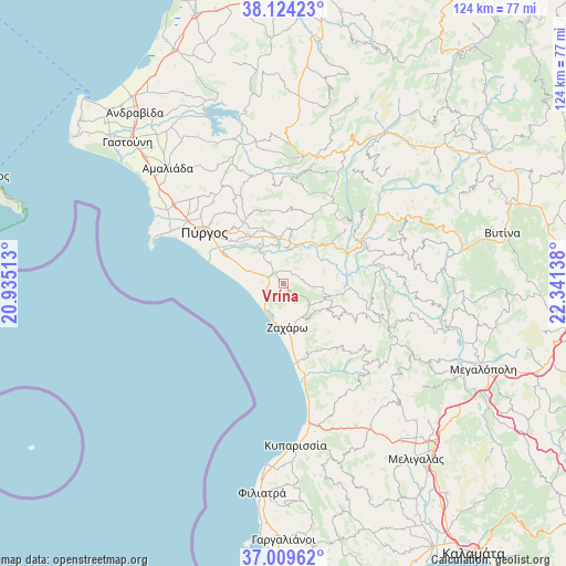
| Upper-left | 38.12423°, | 20.93513° |
| Center: | 37.56901°, | 21.63825° |
| Lower-right: | 37.00962°, | 22.34138° |
| Map W x H: | 123.9×123.9 km | = 77×77mi |
| max Lat: | 41.72048° ⇑85.2% North |
| Vrína: | 37.56901° |
| min Lat: | ⇓14.8% South 34.8346° |
| min Long | Vrína | max Long |
| 19.40494° | 21.63825° | 29.59361° |
| W 20%⇐ | ⇒80% E |
Elevation
Elevation of Vrína is 186 m = 610 ft, and this is 17.1 m = 56 ft above average elevation for this country.
| Max E: |
1439 m = 4721 ft | 27.3% |
| Vrína | 186 m 610 ft | |
| Avg. | 168.9 m = 554 ft | |
Min E: |
0 m = 0 ft | 72.7% |
See also: Greece elevation on elevation.city.
Geographical zone
Vrína is located in North temperate zone (between Tropic of Cancer and the Arctic Circle). Distance of this Northern Tropic circle is 1571.4 km =976.4 mi to South.| Distance of | km | miles | from Vrína |
|---|---|---|---|
| North Pole | 5829.8 | 3622.5 | to North |
| Arctic Circle | 3223.9 | 2003.2 | to North |
| Tropic Cancer | 1571.4 | 976.4 | to South |
| Equator | 4177.3 | 2595.7 | to South |


Nearby cities:
15 places around Vrína: (largest is in red/bold)
• Alfeioúsa
11.9 km =7.4 mi,  311°
311°
• Andrítsaina
25.4 km =15.8 mi,  111°
111°
• Archaía Olympía
8.8 km =5.5 mi,  353°
353°
• Epitálio
14.1 km =8.8 mi,  297°
297°
• Goúmero
21.6 km =13.4 mi,  355°
355°
• Kallithéa
16.1 km =10 mi,  96°
96°
• Karátoula
20.6 km =12.8 mi,  334°
334°
• Kréstena
3 km =1.9 mi, 328°
• Lálas
17.2 km =10.7 mi,  25°
25°
• Makrísia
5.4 km =3.4 mi, 327°
• Pelópi
12.4 km =7.7 mi,  341°
341°
• Plátanos
11.2 km =7 mi, 347°
• Pýrgos
21 km =13 mi, 304°
• Varvásaina
16.7 km =10.4 mi, 312°
• Zacháro
9.6 km =6 mi,  173°
173°
Sources, notices
• [Note1] Compared only with cities in Greece existing in our database
• [Src1] Map data: © OpenStreetMap contributors (CC-BY-SA)
• [Src2] Other city data from geonames.org with taken over terms of usage.
• [Src3] Geographical zone / Annual Mean Temperature by Robert A. Rohde @ Wikipedia
