Kréstena geodata
Kréstena (West Greece) is a seat of a third-order administrative division; located in Greece in Europe/Athens (GMT+3) time zone. With population of 1,864 people, there are 555 cities with bigger population in this country. Compared to other cities in Greece, 85% of cities are located further ↑North; 80.6% of cities are located further →East and 50.9% of cities have higher elevation than Kréstena. Note1
Administrative division(s):
- Level 1: West Greece
- Level 2: Nomós Ileías
- Level 3: Dimos Andritsaina-Krestena


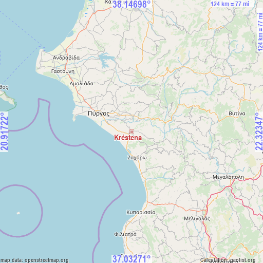
Kréstena GPS coordinates[2]
37° 35' 30.948" North, 21° 37' 13.224" East
| Map corner | latitude | longitude |
|---|---|---|
| Upper-left | 38.14698°, | 20.91722° |
| Center: | 37.59193°, | 21.62034° |
| Lower-right: | 37.03271°, | 22.32347° |
| Map W x H: | 123.9×123.9 km | = 77×77mi |
| max Lat: | 41.72048° ⇑85% North |
| Kréstena: | 37.59193° |
| min Lat: | ⇓15% South 34.8346° |
| min Long | Kréstena | max Long |
| 19.40494° | 21.62034° | 29.59361° |
| W 19.4%⇐ | ⇒80.6% E |
Elevation
Elevation of Kréstena is 78 m = 256 ft, and this is 90.9 m = 298 ft below average elevation for this country.
| Max E: |
1439 m = 4721 ft | 50.9% |
| Avg. | 168.9 m = 554 ft | |
| Kréstena | 78 m = 256 ft | |
Min E: |
0 m = 0 ft | 49.1% |
See also: Greece elevation on elevation.city.
Geographical zone
Kréstena is located in North temperate zone (between Tropic of Cancer and the Arctic Circle). Distance of this Northern Tropic circle is 1573.9 km =978 mi to South.| Distance of | km | miles | from Kréstena |
|---|---|---|---|
| North Pole | 5827.2 | 3620.9 | to North |
| Arctic Circle | 3221.3 | 2001.6 | to North |
| Tropic Cancer | 1573.9 | 978 | to South |
| Equator | 4179.8 | 2597.2 | to South |


Nearby cities:
15 places around Kréstena: (largest is in red/bold)
• Alfeioúsa
9.1 km =5.7 mi,  306°
306°
• Archaía Olympía
6.2 km =3.9 mi,  5°
5°
• Epitálio
11.7 km =7.3 mi,  289°
289°
• Goúmero
19 km =11.8 mi,  359°
359°
• Kallithéa
18.1 km =11.2 mi,  104°
104°
• Karátoula
17.6 km =10.9 mi,  335°
335°
• Lálas
15.8 km =9.8 mi,  34°
34°
• Makrísia
2.4 km =1.5 mi,  325°
325°
• Myrtiá
27.5 km =17.1 mi,  299°
299°
• Pelópi
9.5 km =5.9 mi,  345°
345°
• Plátanos
8.4 km =5.2 mi, 354°
• Pýrgos
18.3 km =11.4 mi, 300°
• Varvásaina
13.9 km =8.6 mi, 309°
• Vrína
3 km =1.9 mi,  148°
148°
• Zacháro
12.4 km =7.7 mi,  167°
167°
Sources, notices
• [Note1] Compared only with cities in Greece existing in our database
• [Src1] Map data: © OpenStreetMap contributors (CC-BY-SA)
• [Src2] Other city data from geonames.org with taken over terms of usage.
• [Src3] Geographical zone / Annual Mean Temperature by Robert A. Rohde @ Wikipedia
