Lálas geodata
Lálas (West Greece) is a populated place; located in Greece in Europe/Athens (GMT+3) time zone. With population of 1,168 people, there are 853 cities with bigger population in this country. Compared to other cities in Greece, 82.7% of cities are located further ↑North; 77.9% of cities are located further →East and 93.1% of cities have lower elevation than Lálas. Note1


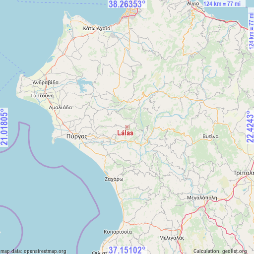
Lálas GPS coordinates[2]
37° 42' 33.696" North, 21° 43' 16.212" East
| Map corner | latitude | longitude |
|---|---|---|
| Upper-left | 38.26353°, | 21.01805° |
| Center: | 37.70936°, | 21.72117° |
| Lower-right: | 37.15102°, | 22.4243° |
| Map W x H: | 123.7×123.7 km | = 76.9×76.9mi |
| max Lat: | 41.72048° ⇑82.7% North |
| Lálas: | 37.70936° |
| min Lat: | ⇓17.3% South 34.8346° |
| min Long | Lálas | max Long |
| 19.40494° | 21.72117° | 29.59361° |
| W 22.1%⇐ | ⇒77.9% E |
Elevation
Elevation of Lálas is 608 m = 1995 ft, and this is 439.1 m = 1441 ft above average elevation for this country.
| Max E: |
1439 m = 4721 ft | 6.9% |
| Lálas | 608 m 1995 ft | |
| Avg. | 168.9 m = 554 ft | |
Min E: |
0 m = 0 ft | 93.1% |
See also: Greece elevation on elevation.city.
Geographical zone
Lálas is located in North temperate zone (between Tropic of Cancer and the Arctic Circle). Distance of this Northern Tropic circle is 1587 km =986.1 mi to South.| Distance of | km | miles | from Lálas |
|---|---|---|---|
| North Pole | 5814.2 | 3612.8 | to North |
| Arctic Circle | 3208.3 | 1993.5 | to North |
| Tropic Cancer | 1587 | 986.1 | to South |
| Equator | 4192.9 | 2605.3 | to South |


Nearby cities:
15 places around Lálas: (largest is in red/bold)
• Alfeioúsa
17.9 km =11.1 mi,  244°
244°
• Archaía Olympía
10.7 km =6.6 mi,  230°
230°
• Epitálio
21.9 km =13.6 mi,  245°
245°
• Goúmero
10.8 km =6.7 mi,  303°
303°
• Kallithéa
19.6 km =12.2 mi,  153°
153°
• Karátoula
16.6 km =10.3 mi,  280°
280°
• Kréstena
15.8 km =9.8 mi,  214°
214°
• Langádhia
27.3 km =17 mi,  96°
96°
• Makrísia
15.1 km =9.4 mi,  222°
222°
• Pelópi
11.9 km =7.4 mi, 250°
• Plátanos
10.8 km =6.7 mi, 244°
• Pýrgos
24.9 km =15.5 mi,  261°
261°
• Varvásaina
20 km =12.4 mi, 257°
• Vrína
17.2 km =10.7 mi, 205°
• Zacháro
25.9 km =16.1 mi,  194°
194°
Sources, notices
• [Note1] Compared only with cities in Greece existing in our database
• [Src1] Map data: © OpenStreetMap contributors (CC-BY-SA)
• [Src2] Other city data from geonames.org with taken over terms of usage.
• [Src3] Geographical zone / Annual Mean Temperature by Robert A. Rohde @ Wikipedia
