Tsarítsani geodata
Tsarítsani (Thessaly) is a populated place; located in Greece in Europe/Athens (GMT+3) time zone. With population of 2,514 people, there are 417 cities with bigger population in this country. Compared to other cities in Greece, 65.4% of cities are located further ↓South; 66.8% of cities are located further →East and 81.4% of cities have lower elevation than Tsarítsani. Note1


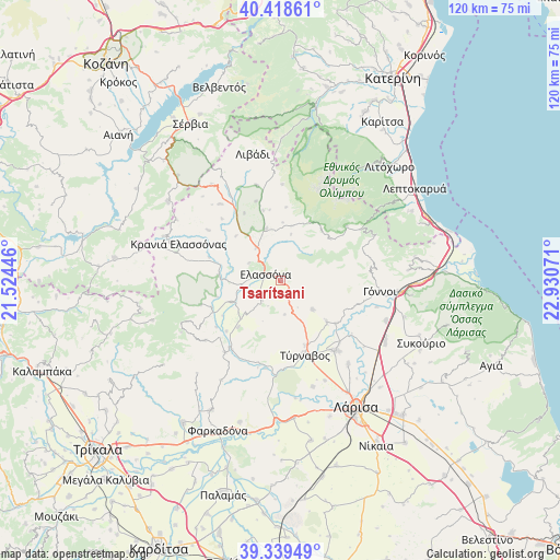
Tsarítsani GPS coordinates[2]
39° 52' 52.212" North, 22° 13' 39.288" East
| Map corner | latitude | longitude |
|---|---|---|
| Upper-left | 40.41861°, | 21.52446° |
| Center: | 39.88117°, | 22.22758° |
| Lower-right: | 39.33949°, | 22.93071° |
| Map W x H: | 120×120 km | = 74.6×74.6mi |
| max Lat: | 41.72048° ⇑34.6% North |
| Tsarítsani: | 39.88117° |
| min Lat: | ⇓65.4% South 34.8346° |
| min Long | Tsarítsani | max Long |
| 19.40494° | 22.22758° | 29.59361° |
| W 33.2%⇐ | ⇒66.8% E |
Elevation
Elevation of Tsarítsani is 306 m = 1004 ft, and this is 137.1 m = 450 ft above average elevation for this country.
| Max E: |
1439 m = 4721 ft | 18.6% |
| Tsarítsani | 306 m 1004 ft | |
| Avg. | 168.9 m = 554 ft | |
Min E: |
0 m = 0 ft | 81.4% |
See also: Greece elevation on elevation.city.
Geographical zone
Tsarítsani is located in North temperate zone (between Tropic of Cancer and the Arctic Circle). Distance of this Northern Tropic circle is 1828.5 km =1136.2 mi to South.| Distance of | km | miles | from Tsarítsani |
|---|---|---|---|
| North Pole | 5572.7 | 3462.7 | to North |
| Arctic Circle | 2966.8 | 1843.5 | to North |
| Tropic Cancer | 1828.5 | 1136.2 | to South |
| Equator | 4434.4 | 2755.4 | to South |


Nearby cities:
15 places around Tsarítsani: (largest is in red/bold)
• Ampelóna
19.2 km =11.9 mi,  142°
142°
• Argyropoúli
9.2 km =5.7 mi,  132°
132°
• Elassóna
3.7 km =2.3 mi,  294°
294°
• Evangelismós
11.5 km =7.1 mi,  246°
246°
• Fálanna
23.1 km =14.4 mi, 141°
• Gónnoi
21.4 km =13.3 mi,  95°
95°
• Kalývia
15.8 km =9.8 mi,  4°
4°
• Kraniá Elassónas
23.2 km =14.4 mi, 289°
• Makrychóri
23.6 km =14.7 mi,  112°
112°
• Pýthio
20.6 km =12.8 mi, 0°
• Sarantáporo
25.6 km =15.9 mi,  324°
324°
• Týrnavos
16.8 km =10.4 mi,  161°
161°
• Verdikoússa
24.1 km =15 mi,  242°
242°
• Vlachogiánni
19.5 km =12.1 mi,  217°
217°
• Ázoros
18.3 km =11.4 mi, 316°
Sources, notices
• [Note1] Compared only with cities in Greece existing in our database
• [Src1] Map data: © OpenStreetMap contributors (CC-BY-SA)
• [Src2] Other city data from geonames.org with taken over terms of usage.
• [Src3] Geographical zone / Annual Mean Temperature by Robert A. Rohde @ Wikipedia
