Skotoússa geodata
Skotoússa (Central Macedonia) is a populated place; located in Greece in Europe/Athens (GMT+3) time zone. With population of 1,415 people, there are 711 cities with bigger population in this country. Compared to other cities in Greece, 96.1% of cities are located further ↓South; 61.9% of cities are located further ←West and 71.8% of cities have higher elevation than Skotoússa. Note1
Administrative division(s):
- Level 1: Central Macedonia
- Level 2: Nomós Serrón
- Level 3: Dimos Irakleia


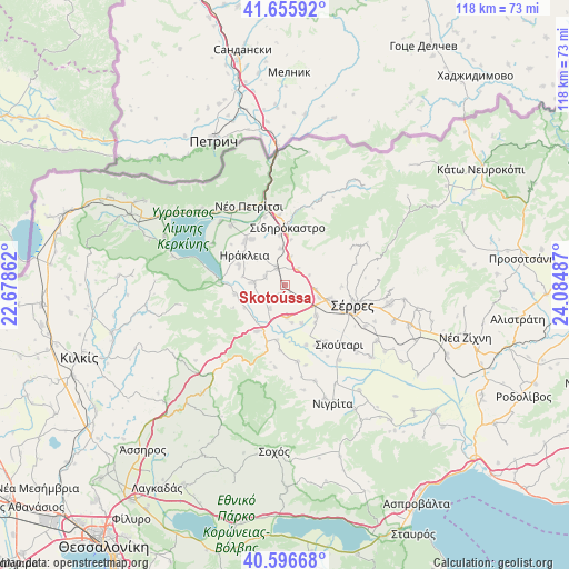
Skotoússa GPS coordinates[2]
41° 7' 42.384" North, 23° 22' 54.264" East
| Map corner | latitude | longitude |
|---|---|---|
| Upper-left | 41.65592°, | 22.67862° |
| Center: | 41.12844°, | 23.38174° |
| Lower-right: | 40.59668°, | 24.08487° |
| Map W x H: | 117.8×117.8 km | = 73.2×73.2mi |
| max Lat: | 41.72048° ⇑3.9% North |
| Skotoússa: | 41.12844° |
| min Lat: | ⇓96.1% South 34.8346° |
| min Long | Skotoússa | max Long |
| 19.40494° | 23.38174° | 29.59361° |
| W 61.9%⇐ | ⇒38.1% E |
Elevation
Elevation of Skotoússa is 28 m = 92 ft, and this is 140.9 m = 462 ft below average elevation for this country.
| Max E: |
1439 m = 4721 ft | 71.8% |
| Avg. | 168.9 m = 554 ft | |
| Skotoússa | 28 m = 92 ft | |
Min E: |
0 m = 0 ft | 28.2% |
See also: Greece elevation on elevation.city.
Geographical zone
Skotoússa is located in North temperate zone (between Tropic of Cancer and the Arctic Circle). Distance of this Northern Tropic circle is 1967.1 km =1222.3 mi to South.| Distance of | km | miles | from Skotoússa |
|---|---|---|---|
| North Pole | 5434 | 3376.5 | to North |
| Arctic Circle | 2828.1 | 1757.3 | to North |
| Tropic Cancer | 1967.1 | 1222.3 | to South |
| Equator | 4573.1 | 2841.6 | to South |


Nearby cities:
15 places around Skotoússa: (largest is in red/bold)
• Ammoudhiá
4.2 km =2.6 mi,  292°
292°
• Anayénnisis
4.6 km =2.9 mi,  243°
243°
• Gefyroúdi
3.8 km =2.4 mi,  333°
333°
• Kalá Déndra
4.8 km =3 mi,  132°
132°
• Karperí
6.5 km =4 mi,  273°
273°
• Lefkónas
10.1 km =6.3 mi,  108°
108°
• Melenikítsi
5.7 km =3.5 mi,  67°
67°
• Mitroúsi
9.2 km =5.7 mi, 134°
• Néa Tirolóï
1.7 km =1.1 mi,  194°
194°
• Palaiókastro
4.1 km =2.5 mi,  40°
40°
• Provatás
6.7 km =4.2 mi,  173°
173°
• Valteró
7.6 km =4.7 mi,  317°
317°
• Vamvakiá
5.8 km =3.6 mi,  211°
211°
• Vamvakófyto
5.8 km =3.6 mi,  11°
11°
• Áno Kamíla
8.7 km =5.4 mi,  156°
156°
Sources, notices
• [Note1] Compared only with cities in Greece existing in our database
• [Src1] Map data: © OpenStreetMap contributors (CC-BY-SA)
• [Src2] Other city data from geonames.org with taken over terms of usage.
• [Src3] Geographical zone / Annual Mean Temperature by Robert A. Rohde @ Wikipedia
