Kalá Déndra geodata
Kalá Déndra (Central Macedonia) is a populated place; located in Greece in Europe/Athens (GMT+3) time zone. With population of 1,131 people, there are 889 cities with bigger population in this country. Compared to other cities in Greece, 95.2% of cities are located further ↓South; 62.9% of cities are located further ←West and 76.1% of cities have higher elevation than Kalá Déndra. Note1


Kalá Déndra GPS coordinates[2]
41° 5' 57.876" North, 23° 25' 26.256" East
| Map corner | latitude | longitude |
|---|---|---|
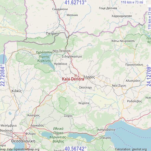
| Upper-left | 41.62713°, | 22.72084° |
| Center: | 41.09941°, | 23.42396° |
| Lower-right: | 40.56742°, | 24.12709° |
| Map W x H: | 117.8×117.8 km | = 73.2×73.2mi |
| max Lat: | 41.72048° ⇑4.8% North |
| Kalá Déndra: | 41.09941° |
| min Lat: | ⇓95.2% South 34.8346° |
| min Long | Kalá Déndra | max Long |
| 19.40494° | 23.42396° | 29.59361° |
| W 62.9%⇐ | ⇒37.1% E |
Elevation
Elevation of Kalá Déndra is 22 m = 72 ft, and this is 146.9 m = 482 ft below average elevation for this country.
| Max E: |
1439 m = 4721 ft | 76.1% |
| Avg. | 168.9 m = 554 ft | |
| Kalá Déndra | 22 m = 72 ft | |
Min E: |
0 m = 0 ft | 23.9% |
See also: Greece elevation on elevation.city.
Geographical zone
Kalá Déndra is located in North temperate zone (between Tropic of Cancer and the Arctic Circle). Distance of this Northern Tropic circle is 1963.9 km =1220.3 mi to South.| Distance of | km | miles | from Kalá Déndra |
|---|---|---|---|
| North Pole | 5437.2 | 3378.5 | to North |
| Arctic Circle | 2831.3 | 1759.3 | to North |
| Tropic Cancer | 1963.9 | 1220.3 | to South |
| Equator | 4569.8 | 2839.5 | to South |


Nearby cities:
15 places around Kalá Déndra: (largest is in red/bold)
• Ammoudhiá
8.9 km =5.5 mi,  303°
303°
• Anayénnisis
7.7 km =4.8 mi,  278°
278°
• Gefyroúdi
8.5 km =5.3 mi,  321°
321°
• Káto Kamíla
10 km =6.2 mi,  150°
150°
• Lefkónas
6.1 km =3.8 mi,  89°
89°
• Melenikítsi
5.7 km =3.5 mi,  17°
17°
• Mitroúsi
4.5 km =2.8 mi,  136°
136°
• Néa Tirolóï
4.3 km =2.7 mi,  291°
291°
• Palaiókastro
6.4 km =4 mi,  351°
351°
• Provatás
4.5 km =2.8 mi,  219°
219°
• Skotoússa
4.8 km =3 mi,  312°
312°
• Sérres
10.5 km =6.5 mi,  98°
98°
• Vamvakiá
6.7 km =4.2 mi,  255°
255°
• Vamvakófyto
9.2 km =5.7 mi, 345°
• Áno Kamíla
4.7 km =2.9 mi,  180°
180°
Sources, notices
• [Note1] Compared only with cities in Greece existing in our database
• [Src1] Map data: © OpenStreetMap contributors (CC-BY-SA)
• [Src2] Other city data from geonames.org with taken over terms of usage.
• [Src3] Geographical zone / Annual Mean Temperature by Robert A. Rohde @ Wikipedia
