Sápes geodata
Sápes (East Macedonia and Thrace) is a seat of a third-order administrative division; located in Greece in Europe/Athens (GMT+3) time zone. With population of 4,506 people, there are 259 cities with bigger population in this country. Compared to other cities in Greece, 93.4% of cities are located further ↓South; 91.7% of cities are located further ←West and 60.8% of cities have lower elevation than Sápes. Note1
Administrative division(s):
- Level 1: East Macedonia and Thrace
- Level 2: Nomós Rodópis
- Level 3: Dimos Maroneia-Sapes


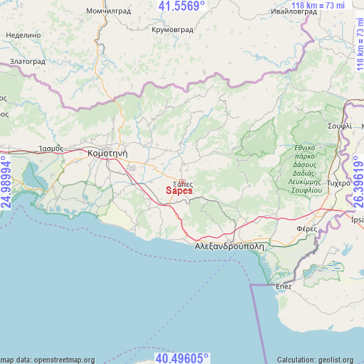
Sápes GPS coordinates[2]
41° 1' 42.996" North, 25° 41' 35.016" East
| Map corner | latitude | longitude |
|---|---|---|
| Upper-left | 41.5569°, | 24.98994° |
| Center: | 41.02861°, | 25.69306° |
| Lower-right: | 40.49605°, | 26.39619° |
| Map W x H: | 118×118 km | = 73.3×73.3mi |
| max Lat: | 41.72048° ⇑6.6% North |
| Sápes: | 41.02861° |
| min Lat: | ⇓93.4% South 34.8346° |
| min Long | Sápes | max Long |
| 19.40494° | 25.69306° | 29.59361° |
| W 91.7%⇐ | ⇒8.3% E |
Elevation
Elevation of Sápes is 120 m = 394 ft, and this is 48.9 m = 160 ft below average elevation for this country.
| Max E: |
1439 m = 4721 ft | 39.2% |
| Avg. | 168.9 m = 554 ft | |
| Sápes | 120 m = 394 ft | |
Min E: |
0 m = 0 ft | 60.8% |
See also: Greece elevation on elevation.city.
Geographical zone
Sápes is located in North temperate zone (between Tropic of Cancer and the Arctic Circle). Distance of this Northern Tropic circle is 1956 km =1215.4 mi to South.| Distance of | km | miles | from Sápes |
|---|---|---|---|
| North Pole | 5445.1 | 3383.4 | to North |
| Arctic Circle | 2839.2 | 1764.2 | to North |
| Tropic Cancer | 1956 | 1215.4 | to South |
| Equator | 4562 | 2834.7 | to South |


Nearby cities:
15 places around Sápes: (largest is in red/bold)
• Alexandroupoli
25.1 km =15.6 mi,  142°
142°
• Arrianá
5.9 km =3.7 mi,  1°
1°
• Arísvi
9.8 km =6.1 mi,  298°
298°
• Fillýra
11 km =6.8 mi,  332°
332°
• Féres
43 km =26.7 mi,  110°
110°
• Komotiní
26.1 km =16.2 mi,  292°
292°
• Loutrós
33.9 km =21.1 mi,  118°
118°
• Lýkeio
4 km =2.5 mi,  351°
351°
• Méga Pistó
35.4 km =22 mi, 291°
• Nípsa
29.4 km =18.3 mi, 112°
• Pagoúria
31.5 km =19.6 mi,  269°
269°
• Xylaganí
23.7 km =14.7 mi,  255°
255°
• Ántheia
30.5 km =19 mi,  125°
125°
• Áratos
13.2 km =8.2 mi, 296°
• Íasmos
43.9 km =27.3 mi,  284°
284°
Sources, notices
• [Note1] Compared only with cities in Greece existing in our database
• [Src1] Map data: © OpenStreetMap contributors (CC-BY-SA)
• [Src2] Other city data from geonames.org with taken over terms of usage.
• [Src3] Geographical zone / Annual Mean Temperature by Robert A. Rohde @ Wikipedia
