Rachóna geodata
Rachóna (Central Macedonia) is a populated place; located in Greece in Europe/Athens (GMT+3) time zone. With population of 691 people, there are 1426 cities with bigger population in this country. Compared to other cities in Greece, 85.8% of cities are located further ↓South; 59.2% of cities are located further →East and 52.8% of cities have lower elevation than Rachóna. Note1


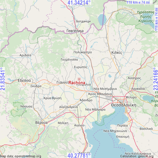
Rachóna GPS coordinates[2]
40° 48' 43.596" North, 22° 32' 18.708" East
| Map corner | latitude | longitude |
|---|---|---|
| Upper-left | 41.34214°, | 21.83541° |
| Center: | 40.81211°, | 22.53853° |
| Lower-right: | 40.27781°, | 23.24166° |
| Map W x H: | 118.3×118.3 km | = 73.5×73.5mi |
| max Lat: | 41.72048° ⇑14.2% North |
| Rachóna: | 40.81211° |
| min Lat: | ⇓85.8% South 34.8346° |
| min Long | Rachóna | max Long |
| 19.40494° | 22.53853° | 29.59361° |
| W 40.8%⇐ | ⇒59.2% E |
Elevation
Elevation of Rachóna is 91 m = 299 ft, and this is 77.9 m = 256 ft below average elevation for this country.
| Max E: |
1439 m = 4721 ft | 47.2% |
| Avg. | 168.9 m = 554 ft | |
| Rachóna | 91 m = 299 ft | |
Min E: |
0 m = 0 ft | 52.8% |
See also: Greece elevation on elevation.city.
Geographical zone
Rachóna is located in North temperate zone (between Tropic of Cancer and the Arctic Circle). Distance of this Northern Tropic circle is 1932 km =1200.5 mi to South.| Distance of | km | miles | from Rachóna |
|---|---|---|---|
| North Pole | 5469.2 | 3398.4 | to North |
| Arctic Circle | 2863.3 | 1779.2 | to North |
| Tropic Cancer | 1932 | 1200.5 | to South |
| Equator | 4537.9 | 2819.7 | to South |


Nearby cities:
15 places around Rachóna: (largest is in red/bold)
• Akropótamos
10.2 km =6.3 mi,  72°
72°
• Chalkidóna
10.3 km =6.4 mi,  149°
149°
• Eleoúsa
10.3 km =6.4 mi,  133°
133°
• Evropós
9.5 km =5.9 mi,  7°
7°
• Giannitsá
11.3 km =7 mi,  258°
258°
• Kastanás
10.1 km =6.3 mi,  85°
85°
• Koufália
4.7 km =2.9 mi,  143°
143°
• Mikró Monastíri
12 km =7.5 mi,  178°
178°
• Néa Pélla
6.5 km =4 mi,  217°
217°
• Paralímni
9.8 km =6.1 mi,  226°
226°
• Pentaplátano
10.1 km =6.3 mi,  274°
274°
• Próchoma
10.9 km =6.8 mi,  98°
98°
• Pélla
5.7 km =3.5 mi,  190°
190°
• Ágios Pétros
7.2 km =4.5 mi,  31°
31°
• Áthyra
4.8 km =3 mi, 71°
Sources, notices
• [Note1] Compared only with cities in Greece existing in our database
• [Src1] Map data: © OpenStreetMap contributors (CC-BY-SA)
• [Src2] Other city data from geonames.org with taken over terms of usage.
• [Src3] Geographical zone / Annual Mean Temperature by Robert A. Rohde @ Wikipedia
