Palaiochóra geodata
Palaiochóra (Central Macedonia) is a populated place; located in Greece in Europe/Athens (GMT+3) time zone. With population of 806 people, there are 1267 cities with bigger population in this country. Compared to other cities in Greece, 74.8% of cities are located further ↓South; 63.6% of cities are located further ←West and 85.2% of cities have lower elevation than Palaiochóra. Note1
Administrative division(s):
- Level 1: Central Macedonia
- Level 2: Nomós Chalkidikís
- Level 3: Dimos Polygyros


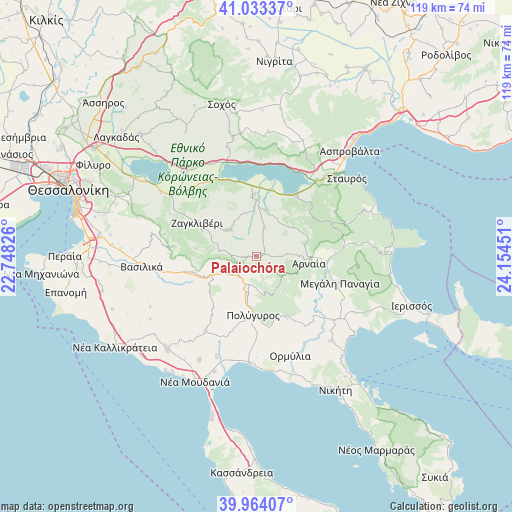
Palaiochóra GPS coordinates[2]
40° 30' 3.06" North, 23° 27' 4.968" East
| Map corner | latitude | longitude |
|---|---|---|
| Upper-left | 41.03337°, | 22.74826° |
| Center: | 40.50085°, | 23.45138° |
| Lower-right: | 39.96407°, | 24.15451° |
| Map W x H: | 118.9×118.9 km | = 73.9×73.9mi |
| max Lat: | 41.72048° ⇑25.2% North |
| Palaiochóra: | 40.50085° |
| min Lat: | ⇓74.8% South 34.8346° |
| min Long | Palaiochóra | max Long |
| 19.40494° | 23.45138° | 29.59361° |
| W 63.6%⇐ | ⇒36.4% E |
Elevation
Elevation of Palaiochóra is 377 m = 1237 ft, and this is 208.1 m = 683 ft above average elevation for this country.
| Max E: |
1439 m = 4721 ft | 14.8% |
| Palaiochóra | 377 m 1237 ft | |
| Avg. | 168.9 m = 554 ft | |
Min E: |
0 m = 0 ft | 85.2% |
See also: Greece elevation on elevation.city.
Geographical zone
Palaiochóra is located in North temperate zone (between Tropic of Cancer and the Arctic Circle). Distance of this Northern Tropic circle is 1897.4 km =1179 mi to South.| Distance of | km | miles | from Palaiochóra |
|---|---|---|---|
| North Pole | 5503.8 | 3419.9 | to North |
| Arctic Circle | 2897.9 | 1800.7 | to North |
| Tropic Cancer | 1897.4 | 1179 | to South |
| Equator | 4503.3 | 2798.2 | to South |


Nearby cities:
15 places around Palaiochóra: (largest is in red/bold)
• Arnaía
12.3 km =7.6 mi,  97°
97°
• Galátista
14.9 km =9.3 mi,  255°
255°
• Kalamotó
9 km =5.6 mi,  313°
313°
• Megáli Panagía
20.3 km =12.6 mi,  107°
107°
• Neochóri
19.3 km =12 mi,  87°
87°
• Nikomidinó
21.2 km =13.2 mi,  315°
315°
• Néa Apollonía
13.9 km =8.6 mi,  356°
356°
• Palaiochóri
16.8 km =10.4 mi, 93°
• Polýgyros
13.8 km =8.6 mi,  183°
183°
• Stanós
12.7 km =7.9 mi,  67°
67°
• Stívos
20.7 km =12.9 mi, 322°
• Símantra
21 km =13 mi,  214°
214°
• Taxiárchis
10.4 km =6.5 mi,  144°
144°
• Varvára
19.1 km =11.9 mi, 66°
• Vrástama
16 km =9.9 mi,  153°
153°
Sources, notices
• [Note1] Compared only with cities in Greece existing in our database
• [Src1] Map data: © OpenStreetMap contributors (CC-BY-SA)
• [Src2] Other city data from geonames.org with taken over terms of usage.
• [Src3] Geographical zone / Annual Mean Temperature by Robert A. Rohde @ Wikipedia
