Sibinal geodata
Sibinal (San Marcos) is a seat of a second-order administrative division; located in Guatemala in America/Guatemala (GMT-6) time zone. With population of 1,657 people, there are 290 cities with bigger population in this country. Compared to other cities in Guatemala, 74.3% of cities are located further ↓South; 97.9% of cities are located further →East and 94.4% of cities have lower elevation than Sibinal. Note1


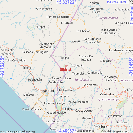
Sibinal GPS coordinates[2]
15° 8' 58.668" North, 92° 2' 56.112" West
| Map corner | latitude | longitude |
|---|---|---|
| Upper-left | 15.82722°, | -92.75205° |
| Center: | 15.14963°, | -92.04892° |
| Lower-right: | 14.46987°, | -91.3458° |
| Map W x H: | 150.9×150.9 km | = 93.8×93.8mi |
| max Lat: | 17.06606° ⇑25.7% North |
| Sibinal: | 15.14963° |
| min Lat: | ⇓74.3% South 13.9274° |
| min Long | Sibinal | max Long |
| -92.19298° | -92.04892° | -88.59444° |
| W 2.1%⇐ | ⇒97.9% E |
Elevation
Elevation of Sibinal is 2532 m = 8307 ft, and this is 1265 m = 4150 ft above average elevation for this country.
| Max E: |
3254 m = 10676 ft | 5.6% |
| Sibinal | 2532 m 8307 ft | |
| Avg. | 1267 m = 4157 ft | |
Min E: |
1 m = 3 ft | 94.4% |
See also: Guatemala elevation on elevation.city.
Geographical zone
Sibinal is located in North Torrid zone (between Equator and Tropic of Cancer). Distance of this Northern Tropic circle is 921.4 km =572.5 mi to North.| Distance of | km | miles | from Sibinal |
|---|---|---|---|
| North Pole | 8322.6 | 5171.4 | to North |
| Arctic Circle | 5716.7 | 3552.2 | to North |
| Tropic Cancer | 921.4 | 572.5 | to North |
| Equator | 1684.5 | 1046.7 | to South |


Nearby cities:
15 places around Sibinal: (largest is in red/bold)
• Catarina
33.1 km =20.6 mi,  185°
185°
• Comitancillo
32.8 km =20.4 mi,  101°
101°
• Concepción Tutuapa
24.1 km =15 mi,  65°
65°
• Cuilco
30.7 km =19.1 mi,  20°
20°
• El Rodeo
27.3 km =17 mi,  163°
163°
• Ixchiguán
12.6 km =7.8 mi,  82°
82°
• Malacatán
26.5 km =16.5 mi,  182°
182°
• San José Ojetenam
12.4 km =7.7 mi,  40°
40°
• San José Ojetenán
11.6 km =7.2 mi,  49°
49°
• San Pablo
24.6 km =15.3 mi,  168°
168°
• San Rafael Pie de la Cuesta
28.4 km =17.6 mi,  149°
149°
• Tacaná
10.3 km =6.4 mi,  349°
349°
• Tajumulco
15.5 km =9.6 mi,  118°
118°
• Tectitán
17.5 km =10.9 mi,  355°
355°
• Tejutla
26.2 km =16.3 mi, 96°
Sources, notices
• [Note1] Compared only with cities in Guatemala existing in our database
• [Src1] Map data: © OpenStreetMap contributors (CC-BY-SA)
• [Src2] Other city data from geonames.org with taken over terms of usage.
• [Src3] Geographical zone / Annual Mean Temperature by Robert A. Rohde @ Wikipedia
