Santo Domingo Xenacoj geodata
Santo Domingo Xenacoj (Sacatepéquez) is a seat of a second-order administrative division; located in Guatemala in America/Guatemala (GMT-6) time zone. With population of 8,791 people, there are 147 cities with bigger population in this country. Compared to other cities in Guatemala, 62.2% of cities are located further ↑North; 59.6% of cities are located further ←West and 70.5% of cities have lower elevation than Santo Domingo Xenacoj. Note1


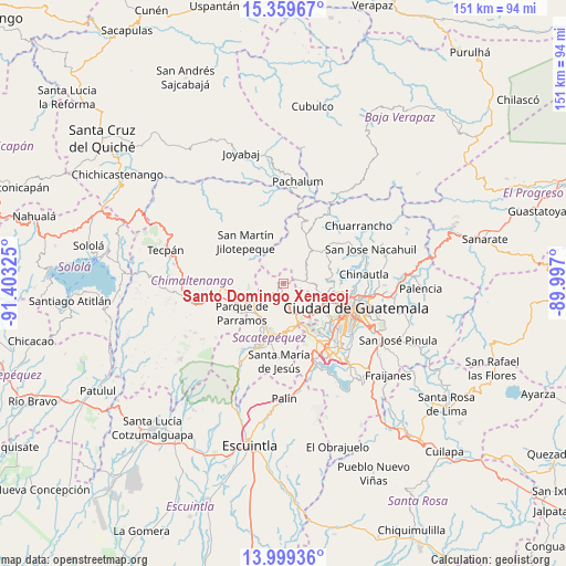
Santo Domingo Xenacoj GPS coordinates[2]
14° 40' 50.052" North, 90° 42' 0.432" West
| Map corner | latitude | longitude |
|---|---|---|
| Upper-left | 15.35967°, | -91.40325° |
| Center: | 14.68057°, | -90.70012° |
| Lower-right: | 13.99936°, | -89.997° |
| Map W x H: | 151.3×151.3 km | = 94×94mi |
| max Lat: | 17.06606° ⇑62.2% North |
| Santo Domingo Xenacoj: | 14.68057° |
| min Lat: | ⇓37.8% South 13.9274° |
| min Long | Santo Domingo X | max Long |
| -92.19298° | -90.70012° | -88.59444° |
| W 59.6%⇐ | ⇒40.4% E |
Elevation
Elevation of Santo Domingo Xenacoj is 1805 m = 5922 ft, and this is 538 m = 1765 ft above average elevation for this country.
| Max E: |
3254 m = 10676 ft | 29.5% |
| Santo Domingo Xenacoj | 1805 m 5922 ft | |
| Avg. | 1267 m = 4157 ft | |
Min E: |
1 m = 3 ft | 70.5% |
See also: Guatemala elevation on elevation.city.
Geographical zone
Santo Domingo Xenacoj is located in North Torrid zone (between Equator and Tropic of Cancer). Distance of this Northern Tropic circle is 973.6 km =605 mi to North.| Distance of | km | miles | from Santo Domingo Xenacoj |
|---|---|---|---|
| North Pole | 8374.7 | 5203.8 | to North |
| Arctic Circle | 5768.8 | 3584.6 | to North |
| Tropic Cancer | 973.6 | 605 | to North |
| Equator | 1632.3 | 1014.3 | to South |


Nearby cities:
15 places around Santo Domingo Xenacoj: (largest is in red/bold)
• Antigua Guatemala
13.8 km =8.6 mi,  195°
195°
• Chimaltenango
13 km =8.1 mi,  260°
260°
• El Tejar
10.5 km =6.5 mi,  249°
249°
• Jocotenango
12.1 km =7.5 mi, 199°
• Mixco
11.4 km =7.1 mi,  118°
118°
• Parramos
13.6 km =8.5 mi,  234°
234°
• Pastores
11.2 km =7 mi,  211°
211°
• San Bartolomé Milpas Altas
8.5 km =5.3 mi,  163°
163°
• San Juan Sacatepéquez
7.4 km =4.6 mi,  54°
54°
• San Lucas Sacatepéquez
9.1 km =5.7 mi,  149°
149°
• San Pedro Sacatepéquez
6.2 km =3.9 mi,  84°
84°
• San Raimundo
14.7 km =9.1 mi, 50°
• Santa Lucía Milpas Altas
11.8 km =7.3 mi,  167°
167°
• Santiago Sacatepéquez
5.7 km =3.5 mi, 153°
• Sumpango
5.3 km =3.3 mi,  223°
223°
Sources, notices
• [Note1] Compared only with cities in Guatemala existing in our database
• [Src1] Map data: © OpenStreetMap contributors (CC-BY-SA)
• [Src2] Other city data from geonames.org with taken over terms of usage.
• [Src3] Geographical zone / Annual Mean Temperature by Robert A. Rohde @ Wikipedia
