San Pedro Necta geodata
San Pedro Necta (Huehuetenango) is a seat of a second-order administrative division; located in Guatemala in America/Guatemala (GMT-6) time zone. With population of 3,554 people, there are 233 cities with bigger population in this country. Compared to other cities in Guatemala, 87.9% of cities are located further ↓South; 89.4% of cities are located further →East and 59.3% of cities have lower elevation than San Pedro Necta. Note1


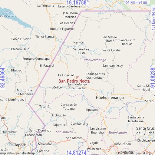
San Pedro Necta GPS coordinates[2]
15° 29' 29.112" North, 91° 45' 55.836" West
| Map corner | latitude | longitude |
|---|---|---|
| Upper-left | 16.16788°, | -92.46864° |
| Center: | 15.49142°, | -91.76551° |
| Lower-right: | 14.81274°, | -91.06239° |
| Map W x H: | 150.7×150.7 km | = 93.6×93.6mi |
| max Lat: | 17.06606° ⇑12.1% North |
| San Pedro Necta: | 15.49142° |
| min Lat: | ⇓87.9% South 13.9274° |
| min Long | San Pedro Necta | max Long |
| -92.19298° | -91.76551° | -88.59444° |
| W 10.6%⇐ | ⇒89.4% E |
Elevation
Elevation of San Pedro Necta is 1513 m = 4964 ft, and this is 246 m = 807 ft above average elevation for this country.
| Max E: |
3254 m = 10676 ft | 40.7% |
| San Pedro Necta | 1513 m 4964 ft | |
| Avg. | 1267 m = 4157 ft | |
Min E: |
1 m = 3 ft | 59.3% |
See also: Guatemala elevation on elevation.city.
Geographical zone
San Pedro Necta is located in North Torrid zone (between Equator and Tropic of Cancer). Distance of this Northern Tropic circle is 883.4 km =548.9 mi to North.| Distance of | km | miles | from San Pedro Necta |
|---|---|---|---|
| North Pole | 8284.6 | 5147.8 | to North |
| Arctic Circle | 5678.7 | 3528.6 | to North |
| Tropic Cancer | 883.4 | 548.9 | to North |
| Equator | 1722.5 | 1070.3 | to South |


Nearby cities:
15 places around San Pedro Necta: (largest is in red/bold)
• Colotenango
11.1 km =6.9 mi,  149°
149°
• Concepción Huista
18.2 km =11.3 mi,  36°
36°
• Cuilco
21.6 km =13.4 mi,  244°
244°
• Ixtahuacán
8.3 km =5.2 mi,  182°
182°
• Jacaltenango
20.3 km =12.6 mi,  16°
16°
• La Democracia
19.8 km =12.3 mi,  318°
318°
• La Libertad
11.4 km =7.1 mi,  282°
282°
• San Antonio Huista
17.7 km =11 mi,  357°
357°
• San Gaspar Ixchil
12.3 km =7.6 mi,  159°
159°
• San Juan Atitán
16.7 km =10.4 mi,  114°
114°
• San Rafael Petzal
14.5 km =9 mi,  131°
131°
• San Sebastián Huehuetenango
19.8 km =12.3 mi, 125°
• Santa Ana Huista
21.9 km =13.6 mi,  344°
344°
• Santiago Chimaltenango
7.6 km =4.7 mi,  102°
102°
• Todos Santos Cuchumatán
17.4 km =10.8 mi,  83°
83°
Sources, notices
• [Note1] Compared only with cities in Guatemala existing in our database
• [Src1] Map data: © OpenStreetMap contributors (CC-BY-SA)
• [Src2] Other city data from geonames.org with taken over terms of usage.
• [Src3] Geographical zone / Annual Mean Temperature by Robert A. Rohde @ Wikipedia
