San Sebastián Huehuetenango geodata
San Sebastián Huehuetenango (Huehuetenango) is a seat of a second-order administrative division; located in Guatemala in America/Guatemala (GMT-6) time zone. With population of 1,311 people, there are 302 cities with bigger population in this country. Compared to other cities in Guatemala, 82.6% of cities are located further ↓South; 80.2% of cities are located further →East and 66.7% of cities have lower elevation than San Sebastián Huehuetenango. Note1
Administrative division(s):
- Level 1: Huehuetenango
- Level 2: Municipio de San Sebastián Huehuetenango
Current local time in San Sebastián Huehuetenango:
02:35 PM, SundayDifference from your time zone: hours


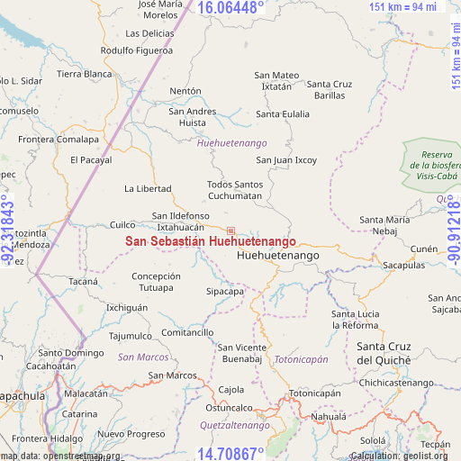
San Sebastián Huehuetenango GPS coordinates[2]
15° 23' 15.648" North, 91° 36' 55.08" West
| Map corner | latitude | longitude |
|---|---|---|
| Upper-left | 16.06448°, | -92.31843° |
| Center: | 15.38768°, | -91.6153° |
| Lower-right: | 14.70867°, | -90.91218° |
| Map W x H: | 150.8×150.8 km | = 93.7×93.7mi |
| max Lat: | 17.06606° ⇑17.4% North |
| San Sebastián Huehuetenango: | 15.38768° |
| min Lat: | ⇓82.6% South 13.9274° |
| min Long | San Sebastián | max Long |
| -92.19298° | -91.6153° | -88.59444° |
| W 19.8%⇐ | ⇒80.2% E |
Elevation
Elevation of San Sebastián Huehuetenango is 1718 m = 5636 ft, and this is 451 m = 1480 ft above average elevation for this country.
| Max E: |
3254 m = 10676 ft | 33.3% |
| San Sebastián Huehuetenango | 1718 m 5636 ft | |
| Avg. | 1267 m = 4157 ft | |
Min E: |
1 m = 3 ft | 66.7% |
See also: Guatemala elevation on elevation.city.
Geographical zone
San Sebastián Huehuetenango is located in North Torrid zone (between Equator and Tropic of Cancer). Distance of this Northern Tropic circle is 895 km =556.1 mi to North.| Distance of | km | miles | from San Sebastián Huehuetenango |
|---|---|---|---|
| North Pole | 8296.1 | 5155 | to North |
| Arctic Circle | 5690.2 | 3535.7 | to North |
| Tropic Cancer | 895 | 556.1 | to North |
| Equator | 1710.9 | 1063.1 | to South |


Nearby cities:
15 places around San Sebastián Huehuetenango: (largest is in red/bold)
• Chiantla
17.2 km =10.7 mi,  102°
102°
• Colotenango
10.6 km =6.6 mi,  281°
281°
• Concepción Huista
26.8 km =16.7 mi,  348°
348°
• Huehuetenango
17.1 km =10.6 mi,  116°
116°
• Ixtahuacán
16.8 km =10.4 mi, 281°
• Malacatancito
20.2 km =12.6 mi,  141°
141°
• San Gaspar Ixchil
11.8 km =7.3 mi,  270°
270°
• San Juan Atitán
4.7 km =2.9 mi, 348°
• San Miguel Ixtahuacán
19.1 km =11.9 mi,  227°
227°
• San Pedro Necta
19.8 km =12.3 mi,  305°
305°
• San Rafael Petzal
5.6 km =3.5 mi,  289°
289°
• Santa Bárbara
8.2 km =5.1 mi,  193°
193°
• Santiago Chimaltenango
13.2 km =8.2 mi,  318°
318°
• Sipacapa
19.6 km =12.2 mi, 185°
• Todos Santos Cuchumatán
13.5 km =8.4 mi,  5°
5°
Sources, notices
• [Note1] Compared only with cities in Guatemala existing in our database
• [Src1] Map data: © OpenStreetMap contributors (CC-BY-SA)
• [Src2] Other city data from geonames.org with taken over terms of usage.
• [Src3] Geographical zone / Annual Mean Temperature by Robert A. Rohde @ Wikipedia
