San Juan Atitán geodata
San Juan Atitán (Huehuetenango) is a seat of a second-order administrative division; located in Guatemala in America/Guatemala (GMT-6) time zone. With population of 1,910 people, there are 281 cities with bigger population in this country. Compared to other cities in Guatemala, 85.5% of cities are located further ↓South; 81.4% of cities are located further →East and 94.1% of cities have lower elevation than San Juan Atitán. Note1


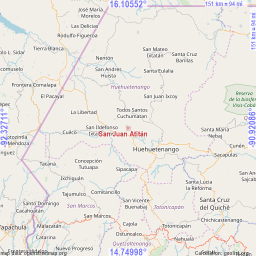
San Juan Atitán GPS coordinates[2]
15° 25' 43.896" North, 91° 37' 26.328" West
| Map corner | latitude | longitude |
|---|---|---|
| Upper-left | 16.10552°, | -92.32711° |
| Center: | 15.42886°, | -91.62398° |
| Lower-right: | 14.74998°, | -90.92086° |
| Map W x H: | 150.7×150.7 km | = 93.6×93.6mi |
| max Lat: | 17.06606° ⇑14.5% North |
| San Juan Atitán: | 15.42886° |
| min Lat: | ⇓85.5% South 13.9274° |
| min Long | San Juan Atitá | max Long |
| -92.19298° | -91.62398° | -88.59444° |
| W 18.6%⇐ | ⇒81.4% E |
Elevation
Elevation of San Juan Atitán is 2524 m = 8281 ft, and this is 1257 m = 4124 ft above average elevation for this country.
| Max E: |
3254 m = 10676 ft | 5.9% |
| San Juan Atitán | 2524 m 8281 ft | |
| Avg. | 1267 m = 4157 ft | |
Min E: |
1 m = 3 ft | 94.1% |
See also: Guatemala elevation on elevation.city.
Geographical zone
San Juan Atitán is located in North Torrid zone (between Equator and Tropic of Cancer). Distance of this Northern Tropic circle is 890.4 km =553.3 mi to North.| Distance of | km | miles | from San Juan Atitán |
|---|---|---|---|
| North Pole | 8291.5 | 5152.1 | to North |
| Arctic Circle | 5685.6 | 3532.9 | to North |
| Tropic Cancer | 890.4 | 553.3 | to North |
| Equator | 1715.5 | 1066 | to South |


Nearby cities:
15 places around San Juan Atitán: (largest is in red/bold)
• Chiantla
19.6 km =12.2 mi,  114°
114°
• Colotenango
9.8 km =6.1 mi,  255°
255°
• Concepción Huista
22.1 km =13.7 mi,  348°
348°
• Huehuetenango
20.3 km =12.6 mi,  126°
126°
• Ixtahuacán
15.6 km =9.7 mi,  265°
265°
• Malacatancito
24.5 km =15.2 mi,  146°
146°
• San Gaspar Ixchil
11.8 km =7.3 mi,  247°
247°
• San Miguel Ixtahuacán
21.9 km =13.6 mi,  217°
217°
• San Pedro Necta
16.7 km =10.4 mi,  294°
294°
• San Rafael Petzal
5.1 km =3.2 mi,  238°
238°
• San Sebastián Huehuetenango
4.7 km =2.9 mi,  168°
168°
• Santa Bárbara
12.6 km =7.8 mi,  184°
184°
• Santiago Chimaltenango
9.4 km =5.8 mi,  304°
304°
• Sipacapa
24.1 km =15 mi, 182°
• Todos Santos Cuchumatán
9.1 km =5.7 mi,  13°
13°
Sources, notices
• [Note1] Compared only with cities in Guatemala existing in our database
• [Src1] Map data: © OpenStreetMap contributors (CC-BY-SA)
• [Src2] Other city data from geonames.org with taken over terms of usage.
• [Src3] Geographical zone / Annual Mean Temperature by Robert A. Rohde @ Wikipedia
