San Antonio Ilotenango geodata
San Antonio Ilotenango (Quiché) is a seat of a second-order administrative division; located in Guatemala in America/Guatemala (GMT-6) time zone. With population of 2,021 people, there are 276 cities with bigger population in this country. Compared to other cities in Guatemala, 69.9% of cities are located further ↓South; 60.5% of cities are located further →East and 74.3% of cities have lower elevation than San Antonio Ilotenango. Note1


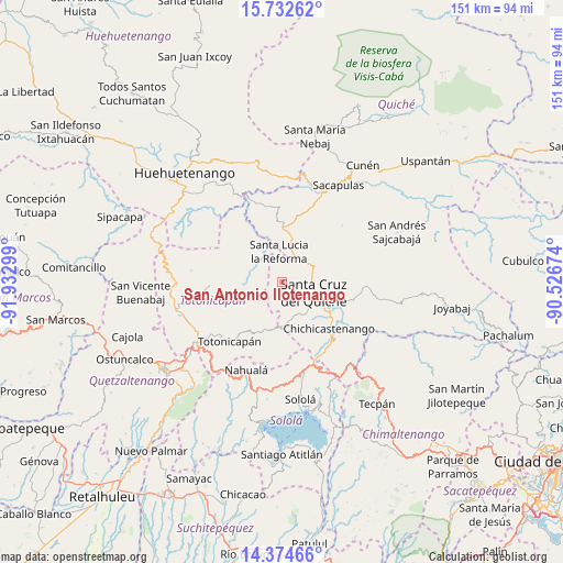
San Antonio Ilotenango GPS coordinates[2]
15° 3' 16.992" North, 91° 13' 47.496" West
| Map corner | latitude | longitude |
|---|---|---|
| Upper-left | 15.73262°, | -91.93299° |
| Center: | 15.05472°, | -91.22986° |
| Lower-right: | 14.37466°, | -90.52674° |
| Map W x H: | 151×151 km | = 93.8×93.8mi |
| max Lat: | 17.06606° ⇑30.1% North |
| San Antonio Ilotenango: | 15.05472° |
| min Lat: | ⇓69.9% South 13.9274° |
| min Long | San Antonio Ilo | max Long |
| -92.19298° | -91.22986° | -88.59444° |
| W 39.5%⇐ | ⇒60.5% E |
Elevation
Elevation of San Antonio Ilotenango is 1946 m = 6385 ft, and this is 679 m = 2228 ft above average elevation for this country.
| Max E: |
3254 m = 10676 ft | 25.7% |
| San Antonio Ilotenango | 1946 m 6385 ft | |
| Avg. | 1267 m = 4157 ft | |
Min E: |
1 m = 3 ft | 74.3% |
See also: Guatemala elevation on elevation.city.
Geographical zone
San Antonio Ilotenango is located in North Torrid zone (between Equator and Tropic of Cancer). Distance of this Northern Tropic circle is 932 km =579.1 mi to North.| Distance of | km | miles | from San Antonio Ilotenango |
|---|---|---|---|
| North Pole | 8333.1 | 5177.9 | to North |
| Arctic Circle | 5727.2 | 3558.7 | to North |
| Tropic Cancer | 932 | 579.1 | to North |
| Equator | 1673.9 | 1040.1 | to South |


Nearby cities:
15 places around San Antonio Ilotenango: (largest is in red/bold)
• Chichicastenango
17.8 km =11.1 mi,  134°
134°
• Chiché
18.5 km =11.5 mi,  105°
105°
• Chinique
21.9 km =13.6 mi,  93°
93°
• Momostenango
19.2 km =11.9 mi,  266°
266°
• Nahualá
25.4 km =15.8 mi,  201°
201°
• Patzité
10.3 km =6.4 mi,  166°
166°
• San Bartolo
24.5 km =15.2 mi,  277°
277°
• San Bartolomé Jocotenango
22.3 km =13.9 mi,  46°
46°
• San Cristóbal Totonicapán
27.3 km =17 mi,  235°
235°
• San Francisco El Alto
26 km =16.2 mi, 241°
• San Pédro Jocopilas
9.6 km =6 mi,  61°
61°
• Santa Cruz del Quiché
9.1 km =5.7 mi, 106°
• Santa Lucia La Reforma
8.2 km =5.1 mi,  355°
355°
• Santa María Chiquimula
11 km =6.8 mi,  255°
255°
• Totonicapán
21.3 km =13.2 mi,  221°
221°
Sources, notices
• [Note1] Compared only with cities in Guatemala existing in our database
• [Src1] Map data: © OpenStreetMap contributors (CC-BY-SA)
• [Src2] Other city data from geonames.org with taken over terms of usage.
• [Src3] Geographical zone / Annual Mean Temperature by Robert A. Rohde @ Wikipedia
