San Bartolo geodata
San Bartolo (Totonicapán) is a seat of a second-order administrative division; located in Guatemala in America/Guatemala (GMT-6) time zone. With population of 1,290 people, there are 305 cities with bigger population in this country. Compared to other cities in Guatemala, 71.4% of cities are located further ↓South; 69.3% of cities are located further →East and 81.1% of cities have lower elevation than San Bartolo. Note1


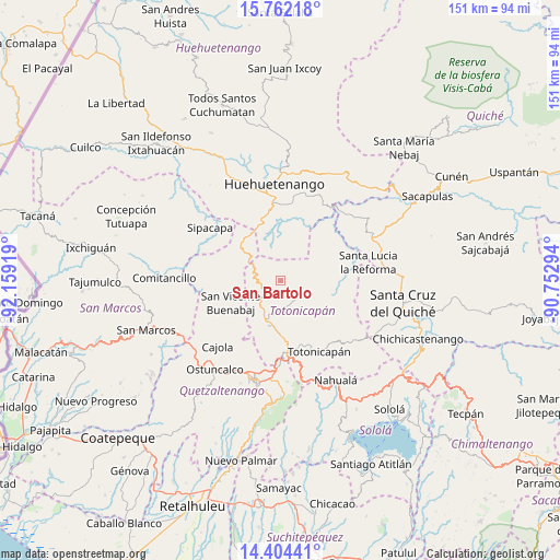
San Bartolo GPS coordinates[2]
15° 5' 3.768" North, 91° 27' 21.816" West
| Map corner | latitude | longitude |
|---|---|---|
| Upper-left | 15.76218°, | -92.15919° |
| Center: | 15.08438°, | -91.45606° |
| Lower-right: | 14.40441°, | -90.75294° |
| Map W x H: | 151×151 km | = 93.8×93.8mi |
| max Lat: | 17.06606° ⇑28.6% North |
| San Bartolo: | 15.08438° |
| min Lat: | ⇓71.4% South 13.9274° |
| min Long | San Bartolo | max Long |
| -92.19298° | -91.45606° | -88.59444° |
| W 30.7%⇐ | ⇒69.3% E |
Elevation
Elevation of San Bartolo is 2116 m = 6942 ft, and this is 849 m = 2785 ft above average elevation for this country.
| Max E: |
3254 m = 10676 ft | 18.9% |
| San Bartolo | 2116 m 6942 ft | |
| Avg. | 1267 m = 4157 ft | |
Min E: |
1 m = 3 ft | 81.1% |
See also: Guatemala elevation on elevation.city.
Geographical zone
San Bartolo is located in North Torrid zone (between Equator and Tropic of Cancer). Distance of this Northern Tropic circle is 928.7 km =577.1 mi to North.| Distance of | km | miles | from San Bartolo |
|---|---|---|---|
| North Pole | 8329.8 | 5175.9 | to North |
| Arctic Circle | 5723.9 | 3556.7 | to North |
| Tropic Cancer | 928.7 | 577.1 | to North |
| Equator | 1677.2 | 1042.2 | to South |


Nearby cities:
15 places around San Bartolo: (largest is in red/bold)
• Cabricán
20.6 km =12.8 mi,  267°
267°
• Huitán
20.1 km =12.5 mi,  258°
258°
• Malacatancito
18.4 km =11.4 mi,  345°
345°
• Momostenango
6.8 km =4.2 mi,  131°
131°
• Olintepeque
22.9 km =14.2 mi,  195°
195°
• Salcajá
22.8 km =14.2 mi,  180°
180°
• San Andrés Xecul
20.2 km =12.6 mi,  188°
188°
• San Carlos Sija
15 km =9.3 mi,  221°
221°
• San Cristóbal Totonicapán
18.7 km =11.6 mi,  174°
174°
• San Francisco El Alto
15.6 km =9.7 mi, 174°
• San Francisco la Unión
20.1 km =12.5 mi,  207°
207°
• Santa María Chiquimula
14.9 km =9.3 mi,  113°
113°
• Sibilia
20.6 km =12.8 mi,  240°
240°
• Sipacapa
23.8 km =14.8 mi,  306°
306°
• Totonicapán
21.7 km =13.5 mi,  152°
152°
Sources, notices
• [Note1] Compared only with cities in Guatemala existing in our database
• [Src1] Map data: © OpenStreetMap contributors (CC-BY-SA)
• [Src2] Other city data from geonames.org with taken over terms of usage.
• [Src3] Geographical zone / Annual Mean Temperature by Robert A. Rohde @ Wikipedia
