Guazacapán geodata
Guazacapán (Santa Rosa) is a seat of a second-order administrative division; located in Guatemala in America/Guatemala (GMT-6) time zone. With population of 7,080 people, there are 173 cities with bigger population in this country. Compared to other cities in Guatemala, 98.2% of cities are located further ↑North; 69% of cities are located further ←West and 85% of cities have higher elevation than Guazacapán. Note1


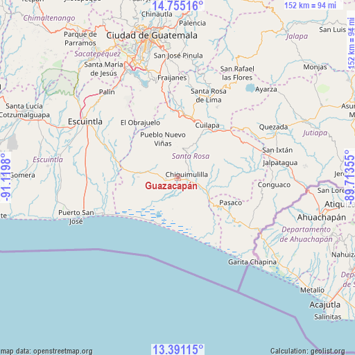
Guazacapán GPS coordinates[2]
14° 4' 27.012" North, 90° 25' 0.012" West
| Map corner | latitude | longitude |
|---|---|---|
| Upper-left | 14.75516°, | -91.1198° |
| Center: | 14.07417°, | -90.41667° |
| Lower-right: | 13.39115°, | -89.71355° |
| Map W x H: | 151.7×151.7 km | = 94.3×94.3mi |
| max Lat: | 17.06606° ⇑98.2% North |
| Guazacapán: | 14.07417° |
| min Lat: | ⇓1.8% South 13.9274° |
| min Long | Guazacapán | max Long |
| -92.19298° | -90.41667° | -88.59444° |
| W 69%⇐ | ⇒31% E |
Elevation
Elevation of Guazacapán is 265 m = 869 ft, and this is 1002 m = 3287 ft below average elevation for this country.
| Max E: |
3254 m = 10676 ft | 85% |
| Avg. | 1267 m = 4157 ft | |
| Guazacapán | 265 m = 869 ft | |
Min E: |
1 m = 3 ft | 15% |
See also: Guatemala elevation on elevation.city.
Geographical zone
Guazacapán is located in North Torrid zone (between Equator and Tropic of Cancer). Distance of this Northern Tropic circle is 1041 km =646.8 mi to North.| Distance of | km | miles | from Guazacapán |
|---|---|---|---|
| North Pole | 8442.2 | 5245.7 | to North |
| Arctic Circle | 5836.3 | 3626.5 | to North |
| Tropic Cancer | 1041 | 646.8 | to North |
| Equator | 1564.9 | 972.4 | to South |


Nearby cities:
15 places around Guazacapán: (largest is in red/bold)
• Barberena
26.6 km =16.5 mi,  12°
12°
• Chiquimulilla
3.5 km =2.2 mi,  72°
72°
• Cuilapa
25.8 km =16 mi,  29°
29°
• Guanagazapa
29.7 km =18.5 mi,  304°
304°
• Iztapa
35.1 km =21.8 mi,  243°
243°
• Moyuta
36.4 km =22.6 mi,  96°
96°
• Nueva Santa Rosa
37.3 km =23.2 mi,  23°
23°
• Oratorio
31.1 km =19.3 mi,  56°
56°
• Pasaco
25.1 km =15.6 mi,  115°
115°
• Pueblo Nuevo Viñas
18 km =11.2 mi,  339°
339°
• San Juan Tecuaco
16.2 km =10.1 mi,  86°
86°
• Santa Cruz Naranjo
35.3 km =21.9 mi, 8°
• Santa María Ixhuatán
20 km =12.4 mi,  49°
49°
• Santa Rosa de Lima
37.3 km =23.2 mi, 20°
• Taxisco
5.6 km =3.5 mi,  262°
262°
Sources, notices
• [Note1] Compared only with cities in Guatemala existing in our database
• [Src1] Map data: © OpenStreetMap contributors (CC-BY-SA)
• [Src2] Other city data from geonames.org with taken over terms of usage.
• [Src3] Geographical zone / Annual Mean Temperature by Robert A. Rohde @ Wikipedia
