Pueblo Nuevo Viñas geodata
Pueblo Nuevo Viñas (Santa Rosa) is a seat of a second-order administrative division; located in Guatemala in America/Guatemala (GMT-6) time zone. With population of 4,211 people, there are 218 cities with bigger population in this country. Compared to other cities in Guatemala, 93.8% of cities are located further ↑North; 67.6% of cities are located further ←West and 51.3% of cities have higher elevation than Pueblo Nuevo Viñas. Note1


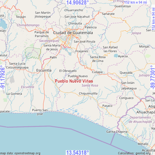
Pueblo Nuevo Viñas GPS coordinates[2]
14° 13' 32.736" North, 90° 28' 34.068" West
| Map corner | latitude | longitude |
|---|---|---|
| Upper-left | 14.90628°, | -91.17926° |
| Center: | 14.22576°, | -90.47613° |
| Lower-right: | 13.54318°, | -89.77301° |
| Map W x H: | 151.6×151.6 km | = 94.2×94.2mi |
| max Lat: | 17.06606° ⇑93.8% North |
| Pueblo Nuevo Viñas: | 14.22576° |
| min Lat: | ⇓6.2% South 13.9274° |
| min Long | Pueblo Nuevo Vi | max Long |
| -92.19298° | -90.47613° | -88.59444° |
| W 67.6%⇐ | ⇒32.4% E |
Elevation
Elevation of Pueblo Nuevo Viñas is 1231 m = 4039 ft, and this is 36 m = 118 ft below average elevation for this country.
| Max E: |
3254 m = 10676 ft | 51.3% |
| Avg. | 1267 m = 4157 ft | |
| Pueblo Nuevo Viñas | 1231 m = 4039 ft | |
Min E: |
1 m = 3 ft | 48.7% |
See also: Guatemala elevation on elevation.city.
Geographical zone
Pueblo Nuevo Viñas is located in North Torrid zone (between Equator and Tropic of Cancer). Distance of this Northern Tropic circle is 1024.2 km =636.4 mi to North.| Distance of | km | miles | from Pueblo Nuevo Viñas |
|---|---|---|---|
| North Pole | 8425.3 | 5235.2 | to North |
| Arctic Circle | 5819.4 | 3616 | to North |
| Tropic Cancer | 1024.2 | 636.4 | to North |
| Equator | 1581.8 | 982.9 | to South |


Nearby cities:
15 places around Pueblo Nuevo Viñas: (largest is in red/bold)
• Barberena
15.3 km =9.5 mi,  53°
53°
• Chiquimulilla
18.6 km =11.6 mi,  148°
148°
• Cuilapa
19.9 km =12.4 mi,  73°
73°
• Fraijanes
26.9 km =16.7 mi,  8°
8°
• Guanagazapa
18 km =11.2 mi,  269°
269°
• Guazacapán
18 km =11.2 mi,  159°
159°
• Nueva Santa Rosa
27.6 km =17.1 mi, 51°
• Palín
30.9 km =19.2 mi,  309°
309°
• San Juan Tecuaco
27.6 km =17.1 mi,  124°
124°
• San Vicente Pacaya
27.2 km =16.9 mi,  320°
320°
• Santa Cruz Naranjo
21.4 km =13.3 mi,  32°
32°
• Santa María Ixhuatán
22.1 km =13.7 mi,  100°
100°
• Santa Rosa de Lima
26.5 km =16.5 mi, 47°
• Taxisco
17.7 km =11 mi,  177°
177°
• Villa Canales
29.3 km =18.2 mi,  347°
347°
Sources, notices
• [Note1] Compared only with cities in Guatemala existing in our database
• [Src1] Map data: © OpenStreetMap contributors (CC-BY-SA)
• [Src2] Other city data from geonames.org with taken over terms of usage.
• [Src3] Geographical zone / Annual Mean Temperature by Robert A. Rohde @ Wikipedia
