El Tumbador geodata
El Tumbador (San Marcos) is a seat of a second-order administrative division; located in Guatemala in America/Guatemala (GMT-6) time zone. With population of 7,562 people, there are 164 cities with bigger population in this country. Compared to other cities in Guatemala, 54.6% of cities are located further ↓South; 95.9% of cities are located further →East and 64.3% of cities have higher elevation than El Tumbador. Note1


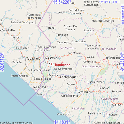
El Tumbador GPS coordinates[2]
14° 51' 49.5" North, 91° 56' 2.976" West
| Map corner | latitude | longitude |
|---|---|---|
| Upper-left | 15.54226°, | -92.63729° |
| Center: | 14.86375°, | -91.93416° |
| Lower-right: | 14.1831°, | -91.23104° |
| Map W x H: | 151.1×151.1 km | = 93.9×93.9mi |
| max Lat: | 17.06606° ⇑45.4% North |
| El Tumbador: | 14.86375° |
| min Lat: | ⇓54.6% South 13.9274° |
| min Long | El Tumbador | max Long |
| -92.19298° | -91.93416° | -88.59444° |
| W 4.1%⇐ | ⇒95.9% E |
Elevation
Elevation of El Tumbador is 867 m = 2844 ft, and this is 400 m = 1312 ft below average elevation for this country.
| Max E: |
3254 m = 10676 ft | 64.3% |
| Avg. | 1267 m = 4157 ft | |
| El Tumbador | 867 m = 2844 ft | |
Min E: |
1 m = 3 ft | 35.7% |
See also: Guatemala elevation on elevation.city.
Geographical zone
El Tumbador is located in North Torrid zone (between Equator and Tropic of Cancer). Distance of this Northern Tropic circle is 953.2 km =592.3 mi to North.| Distance of | km | miles | from El Tumbador |
|---|---|---|---|
| North Pole | 8354.4 | 5191.2 | to North |
| Arctic Circle | 5748.5 | 3572 | to North |
| Tropic Cancer | 953.2 | 592.3 | to North |
| Equator | 1652.7 | 1026.9 | to South |


Nearby cities:
15 places around El Tumbador: (largest is in red/bold)
• Catarina
15.4 km =9.6 mi,  265°
265°
• Coatepeque
19.3 km =12 mi,  157°
157°
• El Quetzal
16.4 km =10.2 mi,  130°
130°
• El Rodeo
7.2 km =4.5 mi,  321°
321°
• Esquipulas Palo Gordo
14.5 km =9 mi,  53°
53°
• La Reforma
13.9 km =8.6 mi,  120°
120°
• Malacatán
14.3 km =8.9 mi,  291°
291°
• Nuevo Progreso
8.2 km =5.1 mi,  168°
168°
• Pajapita
19.2 km =11.9 mi,  214°
214°
• San Antonio Sacatepéquez
24.3 km =15.1 mi,  63°
63°
• San Cristóbal Cucho
17.1 km =10.6 mi,  74°
74°
• San Marcos
18.7 km =11.6 mi, 53°
• San Pablo
10.7 km =6.6 mi, 315°
• San Pedro Sacatepéquez
21.9 km =13.6 mi, 57°
• San Rafael Pie de la Cuesta
7.7 km =4.8 mi,  16°
16°
Sources, notices
• [Note1] Compared only with cities in Guatemala existing in our database
• [Src1] Map data: © OpenStreetMap contributors (CC-BY-SA)
• [Src2] Other city data from geonames.org with taken over terms of usage.
• [Src3] Geographical zone / Annual Mean Temperature by Robert A. Rohde @ Wikipedia
