San Cristóbal Cucho geodata
San Cristóbal Cucho (San Marcos) is a seat of a second-order administrative division; located in Guatemala in America/Guatemala (GMT-6) time zone. With population of 9,152 people, there are 138 cities with bigger population in this country. Compared to other cities in Guatemala, 56.9% of cities are located further ↓South; 90.6% of cities are located further →East and 87.9% of cities have lower elevation than San Cristóbal Cucho. Note1


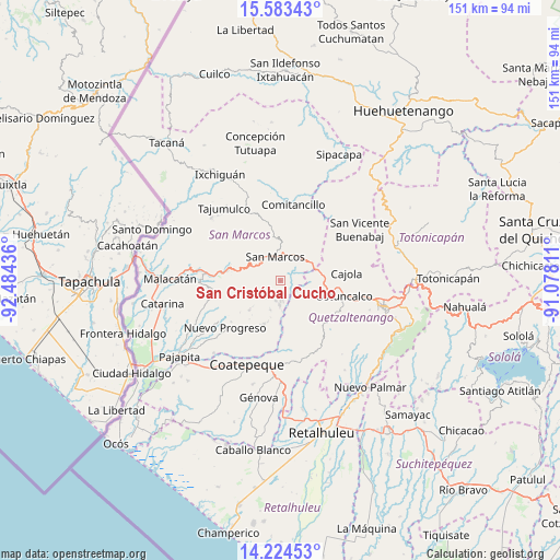
San Cristóbal Cucho GPS coordinates[2]
14° 54' 18.18" North, 91° 46' 52.428" West
| Map corner | latitude | longitude |
|---|---|---|
| Upper-left | 15.58343°, | -92.48436° |
| Center: | 14.90505°, | -91.78123° |
| Lower-right: | 14.22453°, | -91.07811° |
| Map W x H: | 151.1×151.1 km | = 93.9×93.9mi |
| max Lat: | 17.06606° ⇑43.1% North |
| San Cristóbal Cucho: | 14.90505° |
| min Lat: | ⇓56.9% South 13.9274° |
| min Long | San Cristóbal | max Long |
| -92.19298° | -91.78123° | -88.59444° |
| W 9.4%⇐ | ⇒90.6% E |
Elevation
Elevation of San Cristóbal Cucho is 2350 m = 7710 ft, and this is 1083 m = 3553 ft above average elevation for this country.
| Max E: |
3254 m = 10676 ft | 12.1% |
| San Cristóbal Cucho | 2350 m 7710 ft | |
| Avg. | 1267 m = 4157 ft | |
Min E: |
1 m = 3 ft | 87.9% |
See also: Guatemala elevation on elevation.city.
Geographical zone
San Cristóbal Cucho is located in North Torrid zone (between Equator and Tropic of Cancer). Distance of this Northern Tropic circle is 948.6 km =589.4 mi to North.| Distance of | km | miles | from San Cristóbal Cucho |
|---|---|---|---|
| North Pole | 8349.8 | 5188.3 | to North |
| Arctic Circle | 5743.9 | 3569.1 | to North |
| Tropic Cancer | 948.6 | 589.4 | to North |
| Equator | 1657.3 | 1029.8 | to South |


Nearby cities:
15 places around San Cristóbal Cucho: (largest is in red/bold)
• Concepción Chiquirichapa
17.8 km =11.1 mi,  108°
108°
• El Quetzal
15.7 km =9.8 mi,  194°
194°
• El Tumbador
17.1 km =10.6 mi,  254°
254°
• Esquipulas Palo Gordo
6.2 km =3.9 mi,  310°
310°
• La Reforma
12.4 km =7.7 mi,  200°
200°
• Ostuncalco
17.6 km =10.9 mi,  103°
103°
• Palestina de los Altos
9.9 km =6.2 mi,  71°
71°
• San Antonio Sacatepéquez
8.2 km =5.1 mi,  40°
40°
• San Juan Ostuncalco
10.5 km =6.5 mi, 109°
• San Lorenzo
14.8 km =9.2 mi,  19°
19°
• San Marcos
6.7 km =4.2 mi,  347°
347°
• San Martín Sacatepéquez
17.4 km =10.8 mi,  120°
120°
• San Miguel Sigüilá
17.9 km =11.1 mi,  93°
93°
• San Pedro Sacatepéquez
7.3 km =4.5 mi, 16°
• San Rafael Pie de la Cuesta
14.5 km =9 mi,  281°
281°
Sources, notices
• [Note1] Compared only with cities in Guatemala existing in our database
• [Src1] Map data: © OpenStreetMap contributors (CC-BY-SA)
• [Src2] Other city data from geonames.org with taken over terms of usage.
• [Src3] Geographical zone / Annual Mean Temperature by Robert A. Rohde @ Wikipedia
