El Quetzal geodata
El Quetzal (San Marcos) is a seat of a second-order administrative division; located in Guatemala in America/Guatemala (GMT-6) time zone. With population of 12,122 people, there are 101 cities with bigger population in this country. Compared to other cities in Guatemala, 53.7% of cities are located further ↑North; 91.4% of cities are located further →East and 65.8% of cities have higher elevation than El Quetzal. Note1


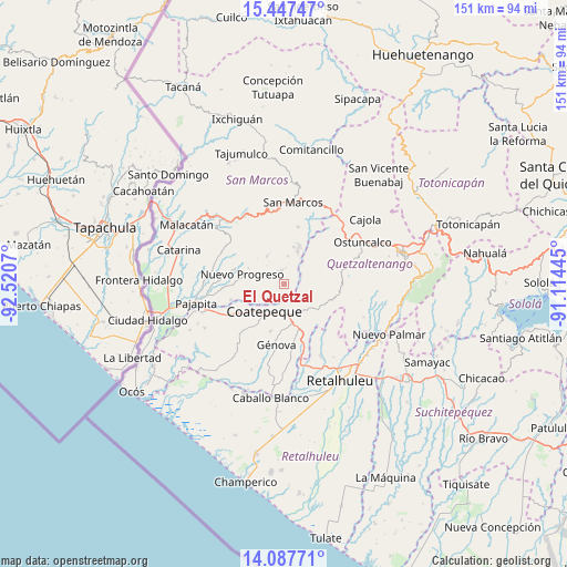
El Quetzal GPS coordinates[2]
14° 46' 7.14" North, 91° 49' 3.252" West
| Map corner | latitude | longitude |
|---|---|---|
| Upper-left | 15.44747°, | -92.5207° |
| Center: | 14.76865°, | -91.81757° |
| Lower-right: | 14.08771°, | -91.11445° |
| Map W x H: | 151.2×151.2 km | = 94×94mi |
| max Lat: | 17.06606° ⇑53.7% North |
| El Quetzal: | 14.76865° |
| min Lat: | ⇓46.3% South 13.9274° |
| min Long | El Quetzal | max Long |
| -92.19298° | -91.81757° | -88.59444° |
| W 8.6%⇐ | ⇒91.4% E |
Elevation
Elevation of El Quetzal is 784 m = 2572 ft, and this is 483 m = 1585 ft below average elevation for this country.
| Max E: |
3254 m = 10676 ft | 65.8% |
| Avg. | 1267 m = 4157 ft | |
| El Quetzal | 784 m = 2572 ft | |
Min E: |
1 m = 3 ft | 34.2% |
See also: Guatemala elevation on elevation.city.
Geographical zone
El Quetzal is located in North Torrid zone (between Equator and Tropic of Cancer). Distance of this Northern Tropic circle is 963.8 km =598.9 mi to North.| Distance of | km | miles | from El Quetzal |
|---|---|---|---|
| North Pole | 8364.9 | 5197.7 | to North |
| Arctic Circle | 5759.1 | 3578.5 | to North |
| Tropic Cancer | 963.8 | 598.9 | to North |
| Equator | 1642.1 | 1020.4 | to South |


Nearby cities:
15 places around El Quetzal: (largest is in red/bold)
• Coatepeque
8.8 km =5.5 mi,  214°
214°
• Colomba
11.5 km =7.1 mi,  126°
126°
• El Asintal
21.5 km =13.4 mi,  153°
153°
• El Tumbador
16.4 km =10.2 mi,  310°
310°
• Esquipulas Palo Gordo
19.2 km =11.9 mi,  357°
357°
• Flores Costa Cuca
15.9 km =9.9 mi,  198°
198°
• Génova
17 km =10.6 mi,  185°
185°
• La Reforma
3.6 km =2.2 mi,  351°
351°
• Nuevo Progreso
11.3 km =7 mi,  283°
283°
• Palestina de los Altos
22.6 km =14 mi,  35°
35°
• San Cristóbal Cucho
15.7 km =9.8 mi,  14°
14°
• San Juan Ostuncalco
18 km =11.2 mi,  49°
49°
• San Marcos
21.9 km =13.6 mi, 6°
• San Martín Sacatepéquez
19.9 km =12.4 mi,  71°
71°
• San Rafael Pie de la Cuesta
20.8 km =12.9 mi,  330°
330°
Sources, notices
• [Note1] Compared only with cities in Guatemala existing in our database
• [Src1] Map data: © OpenStreetMap contributors (CC-BY-SA)
• [Src2] Other city data from geonames.org with taken over terms of usage.
• [Src3] Geographical zone / Annual Mean Temperature by Robert A. Rohde @ Wikipedia
