San Pedro Sacatepéquez geodata
San Pedro Sacatepéquez (San Marcos) is a seat of a second-order administrative division; located in Guatemala in America/Guatemala (GMT-6) time zone. With population of 40,021 people, there are 26 cities with bigger population in this country. Compared to other cities in Guatemala, 65.2% of cities are located further ↓South; 89.1% of cities are located further →East and 89.7% of cities have lower elevation than San Pedro Sacatepéquez. Note1


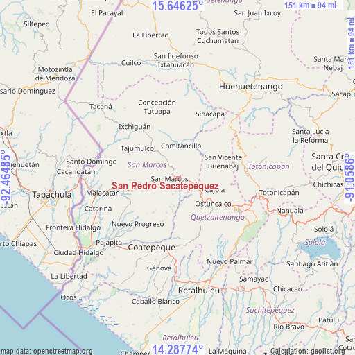
San Pedro Sacatepéquez GPS coordinates[2]
14° 58' 5.052" North, 91° 45' 42.192" West
| Map corner | latitude | longitude |
|---|---|---|
| Upper-left | 15.64625°, | -92.46485° |
| Center: | 14.96807°, | -91.76172° |
| Lower-right: | 14.28774°, | -91.0586° |
| Map W x H: | 151.1×151.1 km | = 93.9×93.9mi |
| max Lat: | 17.06606° ⇑34.8% North |
| San Pedro Sacatepéquez: | 14.96807° |
| min Lat: | ⇓65.2% South 13.9274° |
| min Long | San Pedro Sacat | max Long |
| -92.19298° | -91.76172° | -88.59444° |
| W 10.9%⇐ | ⇒89.1% E |
Elevation
Elevation of San Pedro Sacatepéquez is 2412 m = 7913 ft, and this is 1145 m = 3757 ft above average elevation for this country.
| Max E: |
3254 m = 10676 ft | 10.3% |
| San Pedro Sacatepéquez | 2412 m 7913 ft | |
| Avg. | 1267 m = 4157 ft | |
Min E: |
1 m = 3 ft | 89.7% |
See also: San Pedro Sacatepéquez elevation on elevation.city.
Geographical zone
San Pedro Sacatepéquez is located in North Torrid zone (between Equator and Tropic of Cancer). Distance of this Northern Tropic circle is 941.6 km =585.1 mi to North.| Distance of | km | miles | from San Pedro Sacatepéquez |
|---|---|---|---|
| North Pole | 8342.8 | 5184 | to North |
| Arctic Circle | 5736.9 | 3564.7 | to North |
| Tropic Cancer | 941.6 | 585.1 | to North |
| Equator | 1664.3 | 1034.1 | to South |


Nearby cities:
15 places around San Pedro Sacatepéquez: (largest is in red/bold)
• Cabricán
17 km =10.6 mi,  45°
45°
• Cajolá
16.6 km =10.3 mi,  107°
107°
• Comitancillo
13.5 km =8.4 mi,  5°
5°
• Esquipulas Palo Gordo
7.5 km =4.7 mi,  246°
246°
• Huitán
15.9 km =9.9 mi,  55°
55°
• Palestina de los Altos
8.2 km =5.1 mi,  117°
117°
• Río Blanco
11.4 km =7.1 mi, 46°
• San Antonio Sacatepéquez
3.3 km =2.1 mi,  104°
104°
• San Cristóbal Cucho
7.3 km =4.5 mi,  196°
196°
• San Juan Ostuncalco
13.1 km =8.1 mi,  143°
143°
• San Lorenzo
7.5 km =4.7 mi,  22°
22°
• San Marcos
3.5 km =2.2 mi,  262°
262°
• San Miguel Sigüilá
17.8 km =11.1 mi, 117°
• San Rafael Pie de la Cuesta
16.9 km =10.5 mi, 255°
• Sibilia
15.1 km =9.4 mi,  79°
79°
Sources, notices
• [Note1] Compared only with cities in Guatemala existing in our database
• [Src1] Map data: © OpenStreetMap contributors (CC-BY-SA)
• [Src2] Other city data from geonames.org with taken over terms of usage.
• [Src3] Geographical zone / Annual Mean Temperature by Robert A. Rohde @ Wikipedia
