San Antonio Sacatepéquez geodata
San Antonio Sacatepéquez (San Marcos) is a seat of a second-order administrative division; located in Guatemala in America/Guatemala (GMT-6) time zone. With population of 1,658 people, there are 289 cities with bigger population in this country. Compared to other cities in Guatemala, 64% of cities are located further ↓South; 87.3% of cities are located further →East and 89.4% of cities have lower elevation than San Antonio Sacatepéquez. Note1
Current local time in San Antonio Sacatepéquez:
02:00 PM, SundayDifference from your time zone: hours


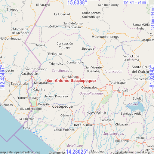
San Antonio Sacatepéquez GPS coordinates[2]
14° 57' 38.16" North, 91° 43' 53.544" West
| Map corner | latitude | longitude |
|---|---|---|
| Upper-left | 15.6388°, | -92.43467° |
| Center: | 14.9606°, | -91.73154° |
| Lower-right: | 14.28025°, | -91.02842° |
| Map W x H: | 151.1×151.1 km | = 93.9×93.9mi |
| max Lat: | 17.06606° ⇑36% North |
| San Antonio Sacatepéquez: | 14.9606° |
| min Lat: | ⇓64% South 13.9274° |
| min Long | San Antonio Sac | max Long |
| -92.19298° | -91.73154° | -88.59444° |
| W 12.7%⇐ | ⇒87.3% E |
Elevation
Elevation of San Antonio Sacatepéquez is 2410 m = 7907 ft, and this is 1143 m = 3750 ft above average elevation for this country.
| Max E: |
3254 m = 10676 ft | 10.6% |
| San Antonio Sacatepéquez | 2410 m 7907 ft | |
| Avg. | 1267 m = 4157 ft | |
Min E: |
1 m = 3 ft | 89.4% |
See also: Guatemala elevation on elevation.city.
Geographical zone
San Antonio Sacatepéquez is located in North Torrid zone (between Equator and Tropic of Cancer). Distance of this Northern Tropic circle is 942.5 km =585.6 mi to North.| Distance of | km | miles | from San Antonio Sacatepéquez |
|---|---|---|---|
| North Pole | 8343.6 | 5184.5 | to North |
| Arctic Circle | 5737.7 | 3565.2 | to North |
| Tropic Cancer | 942.5 | 585.6 | to North |
| Equator | 1663.5 | 1033.7 | to South |


Nearby cities:
15 places around San Antonio Sacatepéquez: (largest is in red/bold)
• Cabricán
15.6 km =9.7 mi,  35°
35°
• Cajolá
13.3 km =8.3 mi,  108°
108°
• Comitancillo
14.5 km =9 mi,  352°
352°
• Esquipulas Palo Gordo
10.3 km =6.4 mi,  258°
258°
• Huitán
14 km =8.7 mi,  45°
45°
• Ostuncalco
15.6 km =9.7 mi,  130°
130°
• Palestina de los Altos
5 km =3.1 mi, 126°
• Río Blanco
10 km =6.2 mi,  30°
30°
• San Cristóbal Cucho
8.2 km =5.1 mi,  220°
220°
• San Juan Ostuncalco
10.7 km =6.6 mi,  155°
155°
• San Lorenzo
7.8 km =4.8 mi,  357°
357°
• San Marcos
6.8 km =4.2 mi,  273°
273°
• San Miguel Sigüilá
14.5 km =9 mi,  119°
119°
• San Pedro Sacatepéquez
3.3 km =2.1 mi,  284°
284°
• Sibilia
12.2 km =7.6 mi,  72°
72°
Sources, notices
• [Note1] Compared only with cities in Guatemala existing in our database
• [Src1] Map data: © OpenStreetMap contributors (CC-BY-SA)
• [Src2] Other city data from geonames.org with taken over terms of usage.
• [Src3] Geographical zone / Annual Mean Temperature by Robert A. Rohde @ Wikipedia
