Esquipulas Palo Gordo geodata
Esquipulas Palo Gordo (San Marcos) is a seat of a second-order administrative division; located in Guatemala in America/Guatemala (GMT-6) time zone. With population of 1,533 people, there are 295 cities with bigger population in this country. Compared to other cities in Guatemala, 62.2% of cities are located further ↓South; 92.3% of cities are located further →East and 91.2% of cities have lower elevation than Esquipulas Palo Gordo. Note1


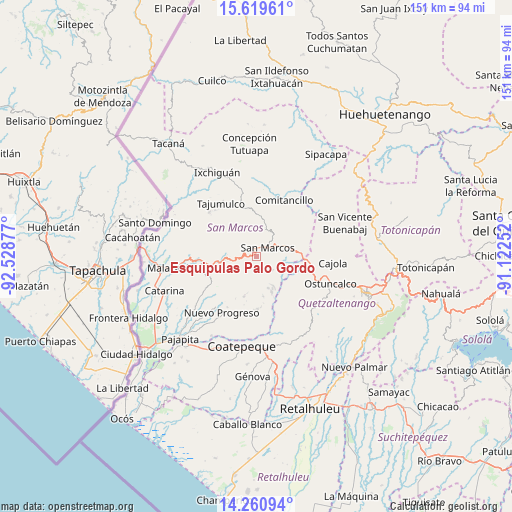
Esquipulas Palo Gordo GPS coordinates[2]
14° 56' 28.86" North, 91° 49' 32.304" West
| Map corner | latitude | longitude |
|---|---|---|
| Upper-left | 15.61961°, | -92.52877° |
| Center: | 14.94135°, | -91.82564° |
| Lower-right: | 14.26094°, | -91.12252° |
| Map W x H: | 151.1×151.1 km | = 93.9×93.9mi |
| max Lat: | 17.06606° ⇑37.8% North |
| Esquipulas Palo Gordo: | 14.94135° |
| min Lat: | ⇓62.2% South 13.9274° |
| min Long | Esquipulas Palo | max Long |
| -92.19298° | -91.82564° | -88.59444° |
| W 7.7%⇐ | ⇒92.3% E |
Elevation
Elevation of Esquipulas Palo Gordo is 2475 m = 8120 ft, and this is 1208 m = 3963 ft above average elevation for this country.
| Max E: |
3254 m = 10676 ft | 8.8% |
| Esquipulas Palo Gordo | 2475 m 8120 ft | |
| Avg. | 1267 m = 4157 ft | |
Min E: |
1 m = 3 ft | 91.2% |
See also: Guatemala elevation on elevation.city.
Geographical zone
Esquipulas Palo Gordo is located in North Torrid zone (between Equator and Tropic of Cancer). Distance of this Northern Tropic circle is 944.6 km =586.9 mi to North.| Distance of | km | miles | from Esquipulas Palo Gordo |
|---|---|---|---|
| North Pole | 8345.7 | 5185.8 | to North |
| Arctic Circle | 5739.9 | 3566.6 | to North |
| Tropic Cancer | 944.6 | 586.9 | to North |
| Equator | 1661.3 | 1032.3 | to South |


Nearby cities:
15 places around Esquipulas Palo Gordo: (largest is in red/bold)
• Comitancillo
18.4 km =11.4 mi,  26°
26°
• El Quetzal
19.2 km =11.9 mi,  177°
177°
• El Rodeo
16.5 km =10.3 mi,  259°
259°
• El Tumbador
14.5 km =9 mi,  233°
233°
• La Reforma
15.6 km =9.7 mi, 178°
• Palestina de los Altos
14.2 km =8.8 mi,  93°
93°
• Río Blanco
18.6 km =11.6 mi,  54°
54°
• San Antonio Sacatepéquez
10.3 km =6.4 mi,  78°
78°
• San Cristóbal Cucho
6.2 km =3.9 mi,  130°
130°
• San Juan Ostuncalco
16.5 km =10.3 mi,  117°
117°
• San Lorenzo
13.9 km =8.6 mi,  44°
44°
• San Marcos
4.2 km =2.6 mi, 53°
• San Pedro Sacatepéquez
7.5 km =4.7 mi,  66°
66°
• San Rafael Pie de la Cuesta
9.6 km =6 mi, 262°
• Tajumulco
18.9 km =11.7 mi,  326°
326°
Sources, notices
• [Note1] Compared only with cities in Guatemala existing in our database
• [Src1] Map data: © OpenStreetMap contributors (CC-BY-SA)
• [Src2] Other city data from geonames.org with taken over terms of usage.
• [Src3] Geographical zone / Annual Mean Temperature by Robert A. Rohde @ Wikipedia
