El Palmar geodata
El Palmar (Quetzaltenango) is a seat of a second-order administrative division; located in Guatemala in America/Guatemala (GMT-6) time zone. With population of 15,167 people, there are 80 cities with bigger population in this country. Compared to other cities in Guatemala, 64% of cities are located further ↑North; 77.6% of cities are located further →East and 67.6% of cities have higher elevation than El Palmar. Note1


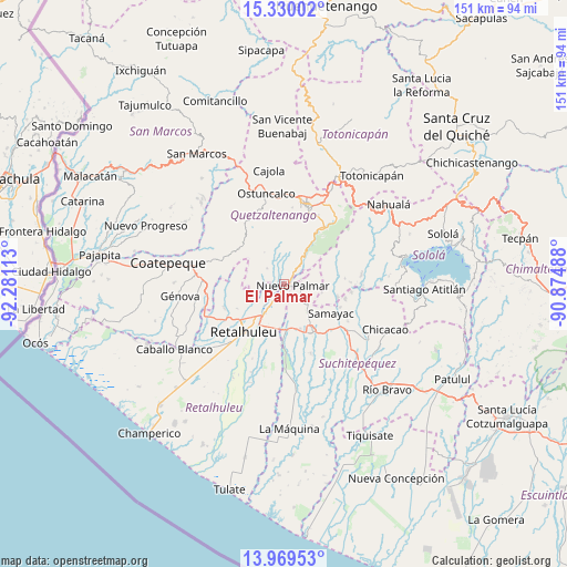
El Palmar GPS coordinates[2]
14° 39' 2.988" North, 91° 34' 40.8" West
| Map corner | latitude | longitude |
|---|---|---|
| Upper-left | 15.33002°, | -92.28113° |
| Center: | 14.65083°, | -91.578° |
| Lower-right: | 13.96953°, | -90.87488° |
| Map W x H: | 151.3×151.3 km | = 94×94mi |
| max Lat: | 17.06606° ⇑64% North |
| El Palmar: | 14.65083° |
| min Lat: | ⇓36% South 13.9274° |
| min Long | El Palmar | max Long |
| -92.19298° | -91.578° | -88.59444° |
| W 22.4%⇐ | ⇒77.6% E |
Elevation
Elevation of El Palmar is 748 m = 2454 ft, and this is 519 m = 1703 ft below average elevation for this country.
| Max E: |
3254 m = 10676 ft | 67.6% |
| Avg. | 1267 m = 4157 ft | |
| El Palmar | 748 m = 2454 ft | |
Min E: |
1 m = 3 ft | 32.4% |
See also: Guatemala elevation on elevation.city.
Geographical zone
El Palmar is located in North Torrid zone (between Equator and Tropic of Cancer). Distance of this Northern Tropic circle is 976.9 km =607 mi to North.| Distance of | km | miles | from El Palmar |
|---|---|---|---|
| North Pole | 8378 | 5205.8 | to North |
| Arctic Circle | 5772.2 | 3586.7 | to North |
| Tropic Cancer | 976.9 | 607 | to North |
| Equator | 1629 | 1012.2 | to South |


Nearby cities:
15 places around El Palmar: (largest is in red/bold)
• Cuyotenango
12.3 km =7.6 mi,  176°
176°
• El Asintal
17.2 km =10.7 mi,  249°
249°
• Mazatenango
15.3 km =9.5 mi,  148°
148°
• Nuevo San Carlos
14 km =8.7 mi,  242°
242°
• Pueblo Nuevo
4.2 km =2.6 mi,  95°
95°
• Retalhuleu
16.7 km =10.4 mi,  220°
220°
• Samayac
14.8 km =9.2 mi,  121°
121°
• San Andrés Villa Seca
8.1 km =5 mi,  185°
185°
• San Felipe
3.6 km =2.2 mi,  210°
210°
• San Francisco Zapotitlán
9.1 km =5.7 mi,  138°
138°
• San Martín Zapotitlán
5.6 km =3.5 mi, 212°
• San Pablo Jocopilas
15.2 km =9.4 mi, 116°
• San Sebastián
12.5 km =7.8 mi, 217°
• Santa Cruz Muluá
9.2 km =5.7 mi, 212°
• Zunilito
8.5 km =5.3 mi, 120°
Sources, notices
• [Note1] Compared only with cities in Guatemala existing in our database
• [Src1] Map data: © OpenStreetMap contributors (CC-BY-SA)
• [Src2] Other city data from geonames.org with taken over terms of usage.
• [Src3] Geographical zone / Annual Mean Temperature by Robert A. Rohde @ Wikipedia
