El Asintal geodata
El Asintal (Retalhuleu) is a seat of a second-order administrative division; located in Guatemala in America/Guatemala (GMT-6) time zone. With population of 6,156 people, there are 187 cities with bigger population in this country. Compared to other cities in Guatemala, 71.1% of cities are located further ↑North; 87% of cities are located further →East and 79.9% of cities have higher elevation than El Asintal. Note1


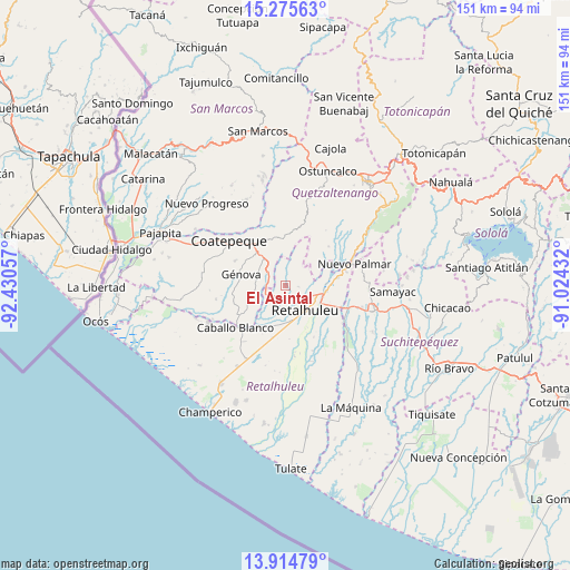
El Asintal GPS coordinates[2]
14° 35' 46.536" North, 91° 43' 38.784" West
| Map corner | latitude | longitude |
|---|---|---|
| Upper-left | 15.27563°, | -92.43057° |
| Center: | 14.59626°, | -91.72744° |
| Lower-right: | 13.91479°, | -91.02432° |
| Map W x H: | 151.3×151.3 km | = 94×94mi |
| max Lat: | 17.06606° ⇑71.1% North |
| El Asintal: | 14.59626° |
| min Lat: | ⇓28.9% South 13.9274° |
| min Long | El Asintal | max Long |
| -92.19298° | -91.72744° | -88.59444° |
| W 13%⇐ | ⇒87% E |
Elevation
Elevation of El Asintal is 371 m = 1217 ft, and this is 896 m = 2940 ft below average elevation for this country.
| Max E: |
3254 m = 10676 ft | 79.9% |
| Avg. | 1267 m = 4157 ft | |
| El Asintal | 371 m = 1217 ft | |
Min E: |
1 m = 3 ft | 20.1% |
See also: Guatemala elevation on elevation.city.
Geographical zone
El Asintal is located in North Torrid zone (between Equator and Tropic of Cancer). Distance of this Northern Tropic circle is 983 km =610.8 mi to North.| Distance of | km | miles | from El Asintal |
|---|---|---|---|
| North Pole | 8384.1 | 5209.6 | to North |
| Arctic Circle | 5778.2 | 3590.4 | to North |
| Tropic Cancer | 983 | 610.8 | to North |
| Equator | 1623 | 1008.5 | to South |


Nearby cities:
15 places around El Asintal: (largest is in red/bold)
• Coatepeque
19 km =11.8 mi,  309°
309°
• Colomba
12.4 km =7.7 mi,  357°
357°
• Cuyotenango
17.9 km =11.1 mi,  110°
110°
• El Palmar
17.2 km =10.7 mi,  69°
69°
• El Quetzal
21.5 km =13.4 mi,  333°
333°
• Flores Costa Cuca
15.2 km =9.4 mi,  285°
285°
• Génova
11.6 km =7.2 mi,  281°
281°
• Nuevo San Carlos
3.6 km =2.2 mi,  95°
95°
• Pueblo Nuevo
21 km =13 mi, 74°
• Retalhuleu
8.6 km =5.3 mi,  141°
141°
• San Andrés Villa Seca
15.4 km =9.6 mi, 97°
• San Felipe
14.6 km =9.1 mi,  78°
78°
• San Martín Zapotitlán
13.1 km =8.1 mi, 84°
• San Sebastián
9.3 km =5.8 mi, 114°
• Santa Cruz Muluá
11.2 km =7 mi, 98°
Sources, notices
• [Note1] Compared only with cities in Guatemala existing in our database
• [Src1] Map data: © OpenStreetMap contributors (CC-BY-SA)
• [Src2] Other city data from geonames.org with taken over terms of usage.
• [Src3] Geographical zone / Annual Mean Temperature by Robert A. Rohde @ Wikipedia
