Retalhuleu geodata
Retalhuleu is a seat of a first-order administrative division; located in Guatemala in America/Guatemala (GMT-6) time zone. With population of 36,656 people, there are 29 cities with bigger population in this country. Compared to other cities in Guatemala, 78.8% of cities are located further ↑North; 84.4% of cities are located further →East and 86.4% of cities have higher elevation than Retalhuleu. Note1


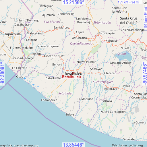
Retalhuleu GPS coordinates[2]
14° 32' 9.996" North, 91° 40' 40.008" West
| Map corner | latitude | longitude |
|---|---|---|
| Upper-left | 15.21566°, | -92.38091° |
| Center: | 14.53611°, | -91.67778° |
| Lower-right: | 13.85446°, | -90.97466° |
| Map W x H: | 151.4×151.4 km | = 94.1×94.1mi |
| max Lat: | 17.06606° ⇑78.8% North |
| Retalhuleu: | 14.53611° |
| min Lat: | ⇓21.2% South 13.9274° |
| min Long | Retalhuleu | max Long |
| -92.19298° | -91.67778° | -88.59444° |
| W 15.6%⇐ | ⇒84.4% E |
Elevation
Elevation of Retalhuleu is 241 m = 791 ft, and this is 1026 m = 3366 ft below average elevation for this country.
| Max E: |
3254 m = 10676 ft | 86.4% |
| Avg. | 1267 m = 4157 ft | |
| Retalhuleu | 241 m = 791 ft | |
Min E: |
1 m = 3 ft | 13.6% |
See also: Guatemala elevation on elevation.city.
Geographical zone
Retalhuleu is located in North Torrid zone (between Equator and Tropic of Cancer). Distance of this Northern Tropic circle is 989.7 km =615 mi to North.| Distance of | km | miles | from Retalhuleu |
|---|---|---|---|
| North Pole | 8390.8 | 5213.8 | to North |
| Arctic Circle | 5784.9 | 3594.6 | to North |
| Tropic Cancer | 989.7 | 615 | to North |
| Equator | 1616.3 | 1004.3 | to South |


Nearby cities:
15 places around Retalhuleu: (largest is in red/bold)
• Cuyotenango
11.4 km =7.1 mi,  87°
87°
• El Asintal
8.6 km =5.3 mi,  321°
321°
• El Palmar
16.7 km =10.4 mi,  40°
40°
• Génova
19 km =11.8 mi,  298°
298°
• Mazatenango
18.8 km =11.7 mi, 90°
• Nuevo San Carlos
6.6 km =4.1 mi,  344°
344°
• Pueblo Nuevo
19.3 km =12 mi,  50°
50°
• San Andrés Villa Seca
11 km =6.8 mi,  64°
64°
• San Felipe
13.1 km =8.1 mi, 42°
• San Francisco Zapotitlán
17.8 km =11.1 mi,  70°
70°
• San Gabriel
18.5 km =11.5 mi,  98°
98°
• San Lorenzo
18.6 km =11.6 mi,  107°
107°
• San Martín Zapotitlán
11.1 km =6.9 mi, 43°
• San Sebastián
4.2 km =2.6 mi, 47°
• Santa Cruz Muluá
7.6 km =4.7 mi, 48°
Sources, notices
• [Note1] Compared only with cities in Guatemala existing in our database
• [Src1] Map data: © OpenStreetMap contributors (CC-BY-SA)
• [Src2] Other city data from geonames.org with taken over terms of usage.
• [Src3] Geographical zone / Annual Mean Temperature by Robert A. Rohde @ Wikipedia
