Santa Cruz Muluá geodata
Santa Cruz Muluá (Retalhuleu) is a seat of a second-order administrative division; located in Guatemala in America/Guatemala (GMT-6) time zone. With population of 2,706 people, there are 251 cities with bigger population in this country. Compared to other cities in Guatemala, 72.9% of cities are located further ↑North; 81.7% of cities are located further →East and 77.9% of cities have higher elevation than Santa Cruz Muluá. Note1


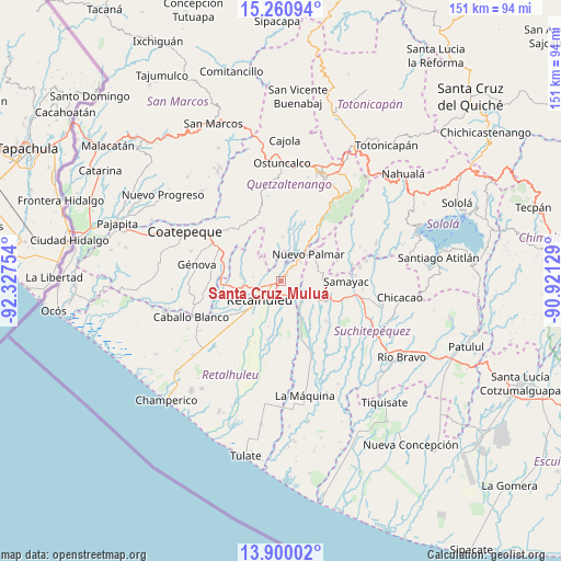
Santa Cruz Muluá GPS coordinates[2]
14° 34' 53.508" North, 91° 37' 27.876" West
| Map corner | latitude | longitude |
|---|---|---|
| Upper-left | 15.26094°, | -92.32754° |
| Center: | 14.58153°, | -91.62441° |
| Lower-right: | 13.90002°, | -90.92129° |
| Map W x H: | 151.3×151.3 km | = 94×94mi |
| max Lat: | 17.06606° ⇑72.9% North |
| Santa Cruz Muluá: | 14.58153° |
| min Lat: | ⇓27.1% South 13.9274° |
| min Long | Santa Cruz Mulu | max Long |
| -92.19298° | -91.62441° | -88.59444° |
| W 18.3%⇐ | ⇒81.7% E |
Elevation
Elevation of Santa Cruz Muluá is 392 m = 1286 ft, and this is 875 m = 2871 ft below average elevation for this country.
| Max E: |
3254 m = 10676 ft | 77.9% |
| Avg. | 1267 m = 4157 ft | |
| Santa Cruz Muluá | 392 m = 1286 ft | |
Min E: |
1 m = 3 ft | 22.1% |
See also: Guatemala elevation on elevation.city.
Geographical zone
Santa Cruz Muluá is located in North Torrid zone (between Equator and Tropic of Cancer). Distance of this Northern Tropic circle is 984.6 km =611.8 mi to North.| Distance of | km | miles | from Santa Cruz Muluá |
|---|---|---|---|
| North Pole | 8385.7 | 5210.6 | to North |
| Arctic Circle | 5779.9 | 3591.5 | to North |
| Tropic Cancer | 984.6 | 611.8 | to North |
| Equator | 1621.3 | 1007.4 | to South |


Nearby cities:
15 places around Santa Cruz Muluá: (largest is in red/bold)
• Cuyotenango
7.3 km =4.5 mi,  129°
129°
• El Asintal
11.2 km =7 mi,  278°
278°
• El Palmar
9.2 km =5.7 mi,  32°
32°
• Mazatenango
14.1 km =8.8 mi,  112°
112°
• Nuevo San Carlos
7.6 km =4.7 mi, 279°
• Pueblo Nuevo
11.7 km =7.3 mi,  51°
51°
• Retalhuleu
7.6 km =4.7 mi,  228°
228°
• San Andrés Villa Seca
4.2 km =2.6 mi,  95°
95°
• San Felipe
5.6 km =3.5 mi, 34°
• San Francisco Zapotitlán
11.1 km =6.9 mi,  85°
85°
• San Gabriel
14.8 km =9.2 mi,  122°
122°
• San Lorenzo
16 km =9.9 mi, 131°
• San Martín Zapotitlán
3.5 km =2.2 mi, 33°
• San Sebastián
3.4 km =2.1 mi, 229°
• Zunilito
12.8 km =8 mi,  74°
74°
Sources, notices
• [Note1] Compared only with cities in Guatemala existing in our database
• [Src1] Map data: © OpenStreetMap contributors (CC-BY-SA)
• [Src2] Other city data from geonames.org with taken over terms of usage.
• [Src3] Geographical zone / Annual Mean Temperature by Robert A. Rohde @ Wikipedia
