Zunilito geodata
Zunilito (Suchitepeque) is a seat of a second-order administrative division; located in Guatemala in America/Guatemala (GMT-6) time zone. With population of 2,745 people, there are 249 cities with bigger population in this country. Compared to other cities in Guatemala, 69.6% of cities are located further ↑North; 73.7% of cities are located further →East and 66.1% of cities have higher elevation than Zunilito. Note1


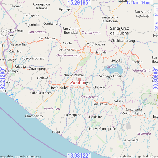
Zunilito GPS coordinates[2]
14° 36' 45.504" North, 91° 30' 35.28" West
| Map corner | latitude | longitude |
|---|---|---|
| Upper-left | 15.29195°, | -92.21293° |
| Center: | 14.61264°, | -91.5098° |
| Lower-right: | 13.93122°, | -90.80668° |
| Map W x H: | 151.3×151.3 km | = 94×94mi |
| max Lat: | 17.06606° ⇑69.6% North |
| Zunilito: | 14.61264° |
| min Lat: | ⇓30.4% South 13.9274° |
| min Long | Zunilito | max Long |
| -92.19298° | -91.5098° | -88.59444° |
| W 26.3%⇐ | ⇒73.7% E |
Elevation
Elevation of Zunilito is 783 m = 2569 ft, and this is 484 m = 1588 ft below average elevation for this country.
| Max E: |
3254 m = 10676 ft | 66.1% |
| Avg. | 1267 m = 4157 ft | |
| Zunilito | 783 m = 2569 ft | |
Min E: |
1 m = 3 ft | 33.9% |
See also: Guatemala elevation on elevation.city.
Geographical zone
Zunilito is located in North Torrid zone (between Equator and Tropic of Cancer). Distance of this Northern Tropic circle is 981.1 km =609.6 mi to North.| Distance of | km | miles | from Zunilito |
|---|---|---|---|
| North Pole | 8382.3 | 5208.5 | to North |
| Arctic Circle | 5776.4 | 3589.3 | to North |
| Tropic Cancer | 981.1 | 609.6 | to North |
| Equator | 1624.8 | 1009.6 | to South |


Nearby cities:
15 places around Zunilito: (largest is in red/bold)
• Cuyotenango
10.5 km =6.5 mi,  219°
219°
• El Palmar
8.5 km =5.3 mi,  300°
300°
• Mazatenango
8.8 km =5.5 mi,  175°
175°
• Pueblo Nuevo
5 km =3.1 mi,  320°
320°
• Samayac
6.3 km =3.9 mi,  124°
124°
• San Andrés Villa Seca
9 km =5.6 mi,  244°
244°
• San Antonio Suchitepéquez
13.1 km =8.1 mi,  128°
128°
• San Bernardino
9.6 km =6 mi,  144°
144°
• San Felipe
9.2 km =5.7 mi,  277°
277°
• San Francisco Zapotitlán
2.9 km =1.8 mi,  205°
205°
• San Gabriel
11.3 km =7 mi, 178°
• San Martín Zapotitlán
10.4 km =6.5 mi,  267°
267°
• San Pablo Jocopilas
6.8 km =4.2 mi,  113°
113°
• Santa Cruz Muluá
12.8 km =8 mi,  254°
254°
• Santo Tomás La Unión
10.9 km =6.8 mi,  78°
78°
Sources, notices
• [Note1] Compared only with cities in Guatemala existing in our database
• [Src1] Map data: © OpenStreetMap contributors (CC-BY-SA)
• [Src2] Other city data from geonames.org with taken over terms of usage.
• [Src3] Geographical zone / Annual Mean Temperature by Robert A. Rohde @ Wikipedia
