San Miguel Sigüilá geodata
San Miguel Sigüilá (Quetzaltenango) is a seat of a second-order administrative division; located in Guatemala in America/Guatemala (GMT-6) time zone. With population of 7,551 people, there are 165 cities with bigger population in this country. Compared to other cities in Guatemala, 56.3% of cities are located further ↓South; 79.6% of cities are located further →East and 92% of cities have lower elevation than San Miguel Sigüilá. Note1


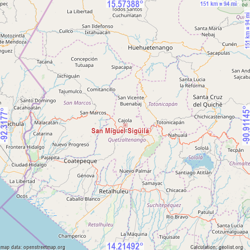
San Miguel Sigüilá GPS coordinates[2]
14° 53' 43.692" North, 91° 36' 52.452" West
| Map corner | latitude | longitude |
|---|---|---|
| Upper-left | 15.57388°, | -92.3177° |
| Center: | 14.89547°, | -91.61457° |
| Lower-right: | 14.21492°, | -90.91145° |
| Map W x H: | 151.1×151.1 km | = 93.9×93.9mi |
| max Lat: | 17.06606° ⇑43.7% North |
| San Miguel Sigüilá: | 14.89547° |
| min Lat: | ⇓56.3% South 13.9274° |
| min Long | San Miguel Sig� | max Long |
| -92.19298° | -91.61457° | -88.59444° |
| W 20.4%⇐ | ⇒79.6% E |
Elevation
Elevation of San Miguel Sigüilá is 2485 m = 8153 ft, and this is 1218 m = 3996 ft above average elevation for this country.
| Max E: |
3254 m = 10676 ft | 8% |
| San Miguel Sigüilá | 2485 m 8153 ft | |
| Avg. | 1267 m = 4157 ft | |
Min E: |
1 m = 3 ft | 92% |
See also: Guatemala elevation on elevation.city.
Geographical zone
San Miguel Sigüilá is located in North Torrid zone (between Equator and Tropic of Cancer). Distance of this Northern Tropic circle is 949.7 km =590.1 mi to North.| Distance of | km | miles | from San Miguel Sigüilá |
|---|---|---|---|
| North Pole | 8350.8 | 5188.9 | to North |
| Arctic Circle | 5745 | 3569.8 | to North |
| Tropic Cancer | 949.7 | 590.1 | to North |
| Equator | 1656.2 | 1029.1 | to South |


Nearby cities:
15 places around San Miguel Sigüilá: (largest is in red/bold)
• Cajolá
3 km =1.9 mi,  359°
359°
• Concepción Chiquirichapa
4.6 km =2.9 mi,  192°
192°
• La Esperanza
6.3 km =3.9 mi,  114°
114°
• Olintepeque
10.8 km =6.7 mi,  95°
95°
• Ostuncalco
3 km =1.9 mi, 193°
• Palestina de los Altos
9.5 km =5.9 mi,  296°
296°
• Quetzaltenango
12.4 km =7.7 mi,  123°
123°
• San Andrés Xecul
14.2 km =8.8 mi,  85°
85°
• San Antonio Sacatepéquez
14.5 km =9 mi, 299°
• San Carlos Sija
12.1 km =7.5 mi,  35°
35°
• San Francisco la Unión
8.4 km =5.2 mi,  68°
68°
• San Juan Ostuncalco
8.4 km =5.2 mi,  253°
253°
• San Martín Sacatepéquez
8.4 km =5.2 mi,  200°
200°
• San Mateo
4.9 km =3 mi,  147°
147°
• Sibilia
11 km =6.8 mi,  354°
354°
Sources, notices
• [Note1] Compared only with cities in Guatemala existing in our database
• [Src1] Map data: © OpenStreetMap contributors (CC-BY-SA)
• [Src2] Other city data from geonames.org with taken over terms of usage.
• [Src3] Geographical zone / Annual Mean Temperature by Robert A. Rohde @ Wikipedia
