San Andrés Xecul geodata
San Andrés Xecul (Totonicapán) is a seat of a second-order administrative division; located in Guatemala in America/Guatemala (GMT-6) time zone. With population of 12,133 people, there are 100 cities with bigger population in this country. Compared to other cities in Guatemala, 56.6% of cities are located further ↓South; 71.7% of cities are located further →East and 90% of cities have lower elevation than San Andrés Xecul. Note1


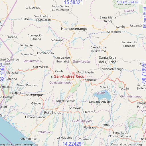
San Andrés Xecul GPS coordinates[2]
14° 54' 17.352" North, 91° 28' 59.052" West
| Map corner | latitude | longitude |
|---|---|---|
| Upper-left | 15.5832°, | -92.1862° |
| Center: | 14.90482°, | -91.48307° |
| Lower-right: | 14.22429°, | -90.77995° |
| Map W x H: | 151.1×151.1 km | = 93.9×93.9mi |
| max Lat: | 17.06606° ⇑43.4% North |
| San Andrés Xecul: | 14.90482° |
| min Lat: | ⇓56.6% South 13.9274° |
| min Long | San Andrés Xec | max Long |
| -92.19298° | -91.48307° | -88.59444° |
| W 28.3%⇐ | ⇒71.7% E |
Elevation
Elevation of San Andrés Xecul is 2420 m = 7940 ft, and this is 1153 m = 3783 ft above average elevation for this country.
| Max E: |
3254 m = 10676 ft | 10% |
| San Andrés Xecul | 2420 m 7940 ft | |
| Avg. | 1267 m = 4157 ft | |
Min E: |
1 m = 3 ft | 90% |
See also: Guatemala elevation on elevation.city.
Geographical zone
San Andrés Xecul is located in North Torrid zone (between Equator and Tropic of Cancer). Distance of this Northern Tropic circle is 948.7 km =589.5 mi to North.| Distance of | km | miles | from San Andrés Xecul |
|---|---|---|---|
| North Pole | 8349.8 | 5188.3 | to North |
| Arctic Circle | 5743.9 | 3569.1 | to North |
| Tropic Cancer | 948.7 | 589.5 | to North |
| Equator | 1657.3 | 1029.8 | to South |


Nearby cities:
15 places around San Andrés Xecul: (largest is in red/bold)
• Almolonga
10 km =6.2 mi,  187°
187°
• Cajolá
14.3 km =8.9 mi,  277°
277°
• Cantel
10.8 km =6.7 mi,  163°
163°
• La Esperanza
9.2 km =5.7 mi,  246°
246°
• Olintepeque
4 km =2.5 mi,  238°
238°
• Quetzaltenango
8.7 km =5.4 mi,  205°
205°
• Salcajá
4 km =2.5 mi,  134°
134°
• San Carlos Sija
11.3 km =7 mi,  321°
321°
• San Cristóbal Totonicapán
4.8 km =3 mi,  73°
73°
• San Francisco El Alto
6.2 km =3.9 mi,  43°
43°
• San Francisco la Unión
6.6 km =4.1 mi,  288°
288°
• San Mateo
12.6 km =7.8 mi, 245°
• San Miguel Sigüilá
14.2 km =8.8 mi,  265°
265°
• Totonicapán
13.1 km =8.1 mi,  86°
86°
• Zunil
13.4 km =8.3 mi,  180°
180°
Sources, notices
• [Note1] Compared only with cities in Guatemala existing in our database
• [Src1] Map data: © OpenStreetMap contributors (CC-BY-SA)
• [Src2] Other city data from geonames.org with taken over terms of usage.
• [Src3] Geographical zone / Annual Mean Temperature by Robert A. Rohde @ Wikipedia
