San José del Boquerón geodata
San José del Boquerón (Cortés) is a populated place; located in Honduras in America/Tegucigalpa (GMT-6) time zone. With population of 1,432 people, there are 258 cities with bigger population in this country. Compared to other cities in Honduras, 83.6% of cities are located further ↓South; 58.4% of cities are located further →East and 90.6% of cities have higher elevation than San José del Boquerón. Note1


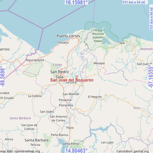
San José del Boquerón GPS coordinates[2]
15° 28' 59.988" North, 87° 52' 0.012" West
| Map corner | latitude | longitude |
|---|---|---|
| Upper-left | 16.15981°, | -88.5698° |
| Center: | 15.48333°, | -87.86667° |
| Lower-right: | 14.80463°, | -87.16355° |
| Map W x H: | 150.7×150.7 km | = 93.6×93.6mi |
| max Lat: | 16.45° ⇑16.4% North |
| San José del Boquerón: | 15.48333° |
| min Lat: | ⇓83.6% South 13.11667° |
| min Long | San José del B | max Long |
| -89.23333° | -87.86667° | -83.23333° |
| W 41.6%⇐ | ⇒58.4% E |
Elevation
Elevation of San José del Boquerón is 22 m = 72 ft, and this is 539.2 m = 1769 ft below average elevation for this country.
| Max E: |
1811 m = 5942 ft | 90.6% |
| Avg. | 561.2 m = 1841 ft | |
| San José del Boquerón | 22 m = 72 ft | |
Min E: |
1 m = 3 ft | 9.4% |
See also: Honduras elevation on elevation.city.
Geographical zone
San José del Boquerón is located in North Torrid zone (between Equator and Tropic of Cancer). Distance of this Northern Tropic circle is 884.3 km =549.5 mi to North.| Distance of | km | miles | from San José del Boquerón |
|---|---|---|---|
| North Pole | 8285.5 | 5148.4 | to North |
| Arctic Circle | 5679.6 | 3529.1 | to North |
| Tropic Cancer | 884.3 | 549.5 | to North |
| Equator | 1721.6 | 1069.8 | to South |


Nearby cities:
15 places around San José del Boquerón: (largest is in red/bold)
• Choloma
17.3 km =10.7 mi,  327°
327°
• Chotepe
14.5 km =9 mi,  239°
239°
• El Milagro
14.2 km =8.8 mi,  229°
229°
• El Progreso
11.7 km =7.3 mi,  142°
142°
• Guaimitas
16.2 km =10.1 mi,  83°
83°
• La Huesa
11.3 km =7 mi,  350°
350°
• La Lima
7.7 km =4.8 mi,  223°
223°
• La Mina
18.9 km =11.7 mi,  169°
169°
• La Sabana
14.8 km =9.2 mi,  208°
208°
• Monterrey
11.3 km =7 mi, 350°
• Nuevo Chamelecón
19.5 km =12.1 mi, 235°
• Quebrada de Yoro
10.5 km =6.5 mi,  121°
121°
• San Manuel
17.5 km =10.9 mi,  197°
197°
• San Pedro Sula
17.1 km =10.6 mi,  277°
277°
• Victoria
4.9 km =3 mi,  62°
62°
Sources, notices
• [Note1] Compared only with cities in Honduras existing in our database
• [Src1] Map data: © OpenStreetMap contributors (CC-BY-SA)
• [Src2] Other city data from geonames.org with taken over terms of usage.
• [Src3] Geographical zone / Annual Mean Temperature by Robert A. Rohde @ Wikipedia
