Tovarnik geodata
Tovarnik (Vukovar-Sirmium) is a seat of a second-order administrative division; located in Croatia in Europe/Zagreb (GMT+2) time zone. With population of 2,337 people, there are 179 cities with bigger population in this country. Compared to other cities in Croatia, 69.9% of cities are located further ↑North; 99.6% of cities are located further ←West and 73.8% of cities have higher elevation than Tovarnik. Note1


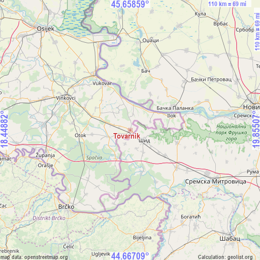
Tovarnik GPS coordinates[2]
45° 9' 54" North, 19° 9' 6.984" East
| Map corner | latitude | longitude |
|---|---|---|
| Upper-left | 45.65859°, | 18.44882° |
| Center: | 45.165°, | 19.15194° |
| Lower-right: | 44.66709°, | 19.85507° |
| Map W x H: | 110.2×110.2 km | = 68.5×68.5mi |
| max Lat: | 46.52694° ⇑69.9% North |
| Tovarnik: | 45.165° |
| min Lat: | ⇓30.1% South 42.54972° |
| min Long | Tovarnik | max Long |
| 13.52389° | 19.15194° | 19.37694° |
| W 99.6%⇐ | ⇒0.40000000000001% E |
Elevation
Elevation of Tovarnik is 90 m = 295 ft, and this is 63.3 m = 208 ft below average elevation for this country.
| Max E: |
827 m = 2713 ft | 73.8% |
| Avg. | 153.3 m = 503 ft | |
| Tovarnik | 90 m = 295 ft | |
Min E: |
-1 m = -3 ft | 26.2% |
See also: Croatia elevation on elevation.city.
Geographical zone
Tovarnik is located in North temperate zone (between Tropic of Cancer and the Arctic Circle). Distance of this North polar circle is 2379.3 km =1478.4 mi to North.| Distance of | km | miles | from Tovarnik |
|---|---|---|---|
| North Pole | 4985.2 | 3097.7 | to North |
| Arctic Circle | 2379.3 | 1478.4 | to North |
| Tropic Cancer | 2416 | 1501.2 | to South |
| Equator | 5021.9 | 3120.5 | to South |


Nearby cities:
15 places around Tovarnik: (largest is in red/bold)
• Bapska
9.2 km =5.7 mi,  66°
66°
• Ilača
4.8 km =3 mi,  292°
292°
• Ilok
18.7 km =11.6 mi, 70°
• Komletinci
16 km =9.9 mi,  263°
263°
• Lovas
7 km =4.3 mi,  12°
12°
• Negoslavci
17.6 km =10.9 mi,  316°
316°
• Nijemci
9.5 km =5.9 mi,  253°
253°
• Orolik
14.2 km =8.8 mi, 293°
• Otok
21.1 km =13.1 mi, 264°
• Petrovcy
21.3 km =13.2 mi,  310°
310°
• Slakovci
17.1 km =10.6 mi, 292°
• Sotin
15.5 km =9.6 mi,  343°
343°
• Srijemske Laze
18.7 km =11.6 mi, 292°
• Tompojevci
8.9 km =5.5 mi,  328°
328°
• Šarengrad
12.6 km =7.8 mi,  53°
53°
Sources, notices
• [Note1] Compared only with cities in Croatia existing in our database
• [Src1] Map data: © OpenStreetMap contributors (CC-BY-SA)
• [Src2] Other city data from geonames.org with taken over terms of usage.
• [Src3] Geographical zone / Annual Mean Temperature by Robert A. Rohde @ Wikipedia
