Šarengrad geodata
Šarengrad (Vukovar-Sirmium) is a populated place; located in Croatia in Europe/Zagreb (GMT+2) time zone. With population of 528 people, there are 846 cities with bigger population in this country. Compared to other cities in Croatia, 64.2% of cities are located further ↑North; 99.9% of cities are located further ←West and 70.1% of cities have higher elevation than Šarengrad. Note1


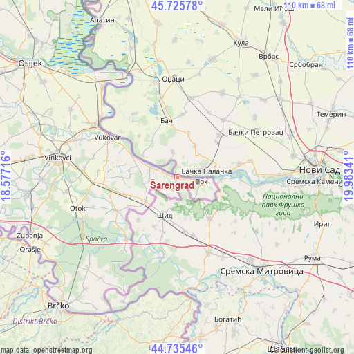
Šarengrad GPS coordinates[2]
45° 13' 58.008" North, 19° 16' 49.008" East
| Map corner | latitude | longitude |
|---|---|---|
| Upper-left | 45.72578°, | 18.57716° |
| Center: | 45.23278°, | 19.28028° |
| Lower-right: | 44.73546°, | 19.98341° |
| Map W x H: | 110.1×110.1 km | = 68.4×68.4mi |
| max Lat: | 46.52694° ⇑64.2% North |
| Šarengrad: | 45.23278° |
| min Lat: | ⇓35.8% South 42.54972° |
| min Long | Šarengrad | max Long |
| 13.52389° | 19.28028° | 19.37694° |
| W 99.9%⇐ | ⇒0.099999999999994% E |
Elevation
Elevation of Šarengrad is 94 m = 308 ft, and this is 59.3 m = 195 ft below average elevation for this country.
| Max E: |
827 m = 2713 ft | 70.1% |
| Avg. | 153.3 m = 503 ft | |
| Šarengrad | 94 m = 308 ft | |
Min E: |
-1 m = -3 ft | 29.9% |
See also: Croatia elevation on elevation.city.
Geographical zone
Šarengrad is located in North temperate zone (between Tropic of Cancer and the Arctic Circle). Distance of this North polar circle is 2371.8 km =1473.8 mi to North.| Distance of | km | miles | from Šarengrad |
|---|---|---|---|
| North Pole | 4977.6 | 3092.9 | to North |
| Arctic Circle | 2371.8 | 1473.8 | to North |
| Tropic Cancer | 2423.5 | 1505.9 | to South |
| Equator | 5029.4 | 3125.1 | to South |


Nearby cities:
15 places around Šarengrad: (largest is in red/bold)
• Bapska
4.2 km =2.6 mi,  202°
202°
• Ilača
15.5 km =9.6 mi,  248°
248°
• Ilok
7.7 km =4.8 mi,  98°
98°
• Komletinci
27.5 km =17.1 mi, 250°
• Lovas
8.6 km =5.3 mi,  265°
265°
• Negoslavci
22.8 km =14.2 mi,  283°
283°
• Nijemci
21.8 km =13.5 mi,  241°
241°
• Orolik
23.2 km =14.4 mi, 265°
• Petrovcy
27 km =16.8 mi, 283°
• Slakovci
25.9 km =16.1 mi, 268°
• Sotin
16.2 km =10.1 mi,  296°
296°
• Srijemske Laze
27.3 km =17 mi, 269°
• Tompojevci
14.7 km =9.1 mi, 270°
• Tovarnik
12.6 km =7.8 mi,  233°
233°
• Vukovar
25.4 km =15.8 mi, 301°
Sources, notices
• [Note1] Compared only with cities in Croatia existing in our database
• [Src1] Map data: © OpenStreetMap contributors (CC-BY-SA)
• [Src2] Other city data from geonames.org with taken over terms of usage.
• [Src3] Geographical zone / Annual Mean Temperature by Robert A. Rohde @ Wikipedia
