Thomassique geodata
Thomassique (Centre) is a populated place; located in Haiti in America/Port-au-Prince (GMT-4) time zone. With population of 4,857 people, there are 45 cities with bigger population in this country. Compared to other cities in Haiti, 52.8% of cities are located further ↓South; 92.5% of cities are located further ←West and 83% of cities have lower elevation than Thomassique. Note1


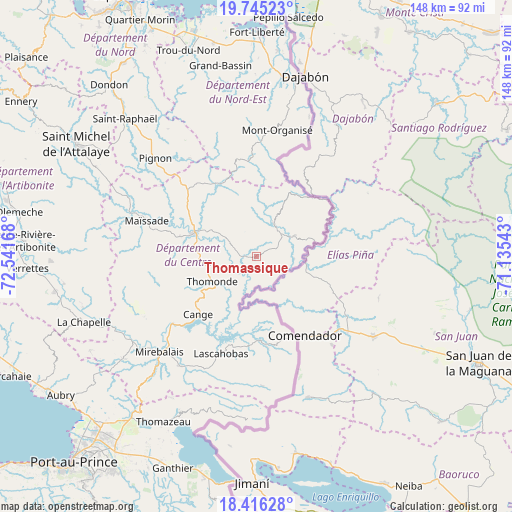
Thomassique GPS coordinates[2]
19° 4' 55.524" North, 71° 50' 18.78" West
| Map corner | latitude | longitude |
|---|---|---|
| Upper-left | 19.74523°, | -72.54168° |
| Center: | 19.08209°, | -71.83855° |
| Lower-right: | 18.41628°, | -71.13543° |
| Map W x H: | 147.8×147.8 km | = 91.8×91.8mi |
| max Lat: | 19.93984° ⇑47.2% North |
| Thomassique: | 19.08209° |
| min Lat: | ⇓52.8% South 18.05° |
| min Long | Thomassique | max Long |
| -74.4528° | -71.83855° | -71.72475° |
| W 92.5%⇐ | ⇒7.5% E |
Elevation
Elevation of Thomassique is 294 m = 965 ft, and this is 148.9 m = 489 ft above average elevation for this country.
| Max E: |
1466 m = 4810 ft | 17% |
| Thomassique | 294 m 965 ft | |
| Avg. | 145.1 m = 476 ft | |
Min E: |
3 m = 10 ft | 83% |
See also: Haiti elevation on elevation.city.
Geographical zone
Thomassique is located in North Torrid zone (between Equator and Tropic of Cancer). Distance of this Northern Tropic circle is 484.2 km =300.9 mi to North.| Distance of | km | miles | from Thomassique |
|---|---|---|---|
| North Pole | 7885.3 | 4899.7 | to North |
| Arctic Circle | 5279.4 | 3280.5 | to North |
| Tropic Cancer | 484.2 | 300.9 | to North |
| Equator | 2121.7 | 1318.4 | to South |


Nearby cities:
15 places around Thomassique: (largest is in red/bold)
• Acul Samedi
48.8 km =30.3 mi,  354°
354°
• Bahon
51.9 km =32.2 mi,  326°
326°
• Carice
32.9 km =20.4 mi,  1°
1°
• Cerca la Source
10.7 km =6.6 mi,  28°
28°
• Cornillon
46.8 km =29.1 mi,  194°
194°
• Hinche
20.2 km =12.6 mi,  291°
291°
• Lascahobas
29.8 km =18.5 mi,  200°
200°
• Mayisad
33.3 km =20.7 mi, 288°
• Mirebalais
39.3 km =24.4 mi,  225°
225°
• Montòrganize
36.7 km =22.8 mi,  9°
9°
• Ouanaminthe
53.3 km =33.1 mi, 12°
• Perches
49.7 km =30.9 mi, 349°
• Pignon
40.6 km =25.2 mi,  314°
314°
• Ranquitte
44.7 km =27.8 mi, 325°
• Thomonde
14.9 km =9.3 mi,  241°
241°
Sources, notices
• [Note1] Compared only with cities in Haiti existing in our database
• [Src1] Map data: © OpenStreetMap contributors (CC-BY-SA)
• [Src2] Other city data from geonames.org with taken over terms of usage.
• [Src3] Geographical zone / Annual Mean Temperature by Robert A. Rohde @ Wikipedia
