Thomonde geodata
Thomonde (Centre) is a populated place; located in Haiti in America/Port-au-Prince (GMT-4) time zone. With population of 3,696 people, there are 56 cities with bigger population in this country. Compared to other cities in Haiti, 50.9% of cities are located further ↓South; 84.9% of cities are located further ←West and 82.1% of cities have lower elevation than Thomonde. Note1


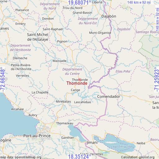
Thomonde GPS coordinates[2]
19° 1' 2.28" North, 71° 57' 44.46" West
| Map corner | latitude | longitude |
|---|---|---|
| Upper-left | 19.68071°, | -72.66548° |
| Center: | 19.0173°, | -71.96235° |
| Lower-right: | 18.35124°, | -71.25923° |
| Map W x H: | 147.8×147.8 km | = 91.8×91.8mi |
| max Lat: | 19.93984° ⇑49.1% North |
| Thomonde: | 19.0173° |
| min Lat: | ⇓50.9% South 18.05° |
| min Long | Thomonde | max Long |
| -74.4528° | -71.96235° | -71.72475° |
| W 84.9%⇐ | ⇒15.1% E |
Elevation
Elevation of Thomonde is 283 m = 928 ft, and this is 137.9 m = 452 ft above average elevation for this country.
| Max E: |
1466 m = 4810 ft | 17.9% |
| Thomonde | 283 m 928 ft | |
| Avg. | 145.1 m = 476 ft | |
Min E: |
3 m = 10 ft | 82.1% |
See also: Haiti elevation on elevation.city.
Geographical zone
Thomonde is located in North Torrid zone (between Equator and Tropic of Cancer). Distance of this Northern Tropic circle is 491.4 km =305.3 mi to North.| Distance of | km | miles | from Thomonde |
|---|---|---|---|
| North Pole | 7892.5 | 4904.2 | to North |
| Arctic Circle | 5286.6 | 3284.9 | to North |
| Tropic Cancer | 491.4 | 305.3 | to North |
| Equator | 2114.5 | 1313.9 | to South |


Nearby cities:
15 places around Thomonde: (largest is in red/bold)
• Bahon
52.8 km =32.8 mi,  342°
342°
• Carice
42.4 km =26.3 mi,  19°
19°
• Cerca la Source
24.6 km =15.3 mi,  47°
47°
• Cornillon
38 km =23.6 mi,  178°
178°
• Désarmes
45.1 km =28 mi,  266°
266°
• Hinche
15.8 km =9.8 mi, 338°
• Lascahobas
21 km =13 mi,  172°
172°
• Mayisad
25.7 km =16 mi,  313°
313°
• Mirebalais
25.2 km =15.7 mi,  216°
216°
• Montòrganize
47.4 km =29.5 mi, 23°
• Pignon
39 km =24.2 mi, 335°
• Ranquitte
45.7 km =28.4 mi, 344°
• Saint-Raphaël
53 km =32.9 mi,  332°
332°
• Thomassique
14.9 km =9.3 mi,  61°
61°
• Thomazeau
42.8 km =26.6 mi,  198°
198°
Sources, notices
• [Note1] Compared only with cities in Haiti existing in our database
• [Src1] Map data: © OpenStreetMap contributors (CC-BY-SA)
• [Src2] Other city data from geonames.org with taken over terms of usage.
• [Src3] Geographical zone / Annual Mean Temperature by Robert A. Rohde @ Wikipedia
