Pásztó geodata
Pásztó (Nógrád) is a seat of a second-order administrative division; located in Hungary in Europe/Budapest (GMT+2) time zone. With population of 10,119 people, there are 165 cities with bigger population in this country. Compared to other cities in Hungary, 83.3% of cities are located further ↓South; 55.1% of cities are located further ←West and 83.4% of cities have lower elevation than Pásztó. Note1


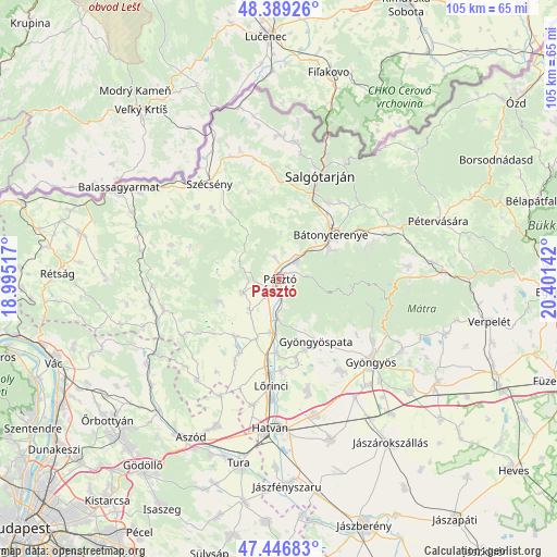
Pásztó GPS coordinates[2]
47° 55' 12.684" North, 19° 41' 53.844" East
| Map corner | latitude | longitude |
|---|---|---|
| Upper-left | 48.38926°, | 18.99517° |
| Center: | 47.92019°, | 19.69829° |
| Lower-right: | 47.44683°, | 20.40142° |
| Map W x H: | 104.8×104.8 km | = 65.1×65.1mi |
| max Lat: | 48.46667° ⇑16.7% North |
| Pásztó: | 47.92019° |
| min Lat: | ⇓83.3% South 45.79108° |
| min Long | Pásztó | max Long |
| 16.27358° | 19.69829° | 22.68096° |
| W 55.1%⇐ | ⇒44.9% E |
Elevation
Elevation of Pásztó is 168 m = 551 ft, and this is 38.3 m = 126 ft above average elevation for this country.
| Max E: |
444 m = 1457 ft | 16.6% |
| Pásztó | 168 m 551 ft | |
| Avg. | 129.7 m = 426 ft | |
Min E: |
71 m = 233 ft | 83.4% |
See also: Hungary elevation on elevation.city.
Geographical zone
Pásztó is located in North temperate zone (between Tropic of Cancer and the Arctic Circle). Distance of this North polar circle is 2072.9 km =1288 mi to North.| Distance of | km | miles | from Pásztó |
|---|---|---|---|
| North Pole | 4678.8 | 2907.3 | to North |
| Arctic Circle | 2072.9 | 1288 | to North |
| Tropic Cancer | 2722.3 | 1691.6 | to South |
| Equator | 5328.2 | 3310.8 | to South |


Nearby cities:
15 places around Pásztó: (largest is in red/bold)
• Apc
14 km =8.7 mi,  181°
181°
• Buják
12.2 km =7.6 mi,  250°
250°
• Bátonyterenye
12 km =7.5 mi,  62°
62°
• Gyöngyöspata
13.5 km =8.4 mi,  149°
149°
• Gyöngyöstarján
17.3 km =10.7 mi,  133°
133°
• Héhalom
17.7 km =11 mi,  208°
208°
• Jobbágyi
9.9 km =6.2 mi,  188°
188°
• Mátraverebély
8.6 km =5.3 mi,  45°
45°
• Palotás
15.8 km =9.8 mi, 208°
• Petőfibánya
16.7 km =10.4 mi, 179°
• Rimóc
18 km =11.2 mi,  316°
316°
• Rózsaszentmárton
15.7 km =9.8 mi,  167°
167°
• Szurdokpüspöki
6.8 km =4.2 mi, 183°
• Tar
5.2 km =3.2 mi,  43°
43°
• Zagyvaszántó
16 km =9.9 mi, 187°
Sources, notices
• [Note1] Compared only with cities in Hungary existing in our database
• [Src1] Map data: © OpenStreetMap contributors (CC-BY-SA)
• [Src2] Other city data from geonames.org with taken over terms of usage.
• [Src3] Geographical zone / Annual Mean Temperature by Robert A. Rohde @ Wikipedia
