Mátraverebély geodata
Mátraverebély (Nógrád) is a populated place; located in Hungary in Europe/Budapest (GMT+2) time zone. With population of 2,197 people, there are 709 cities with bigger population in this country. Compared to other cities in Hungary, 86.6% of cities are located further ↓South; 56.9% of cities are located further ←West and 86.8% of cities have lower elevation than Mátraverebély. Note1


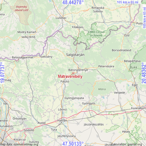
Mátraverebély GPS coordinates[2]
47° 58' 27.156" North, 19° 46' 49.764" East
| Map corner | latitude | longitude |
|---|---|---|
| Upper-left | 48.44278°, | 19.07737° |
| Center: | 47.97421°, | 19.78049° |
| Lower-right: | 47.50135°, | 20.48362° |
| Map W x H: | 104.7×104.7 km | = 65.1×65.1mi |
| max Lat: | 48.46667° ⇑13.4% North |
| Mátraverebély: | 47.97421° |
| min Lat: | ⇓86.6% South 45.79108° |
| min Long | Mátraverebély | max Long |
| 16.27358° | 19.78049° | 22.68096° |
| W 56.9%⇐ | ⇒43.1% E |
Elevation
Elevation of Mátraverebély is 178 m = 584 ft, and this is 48.3 m = 158 ft above average elevation for this country.
| Max E: |
444 m = 1457 ft | 13.2% |
| Mátraverebély | 178 m 584 ft | |
| Avg. | 129.7 m = 426 ft | |
Min E: |
71 m = 233 ft | 86.8% |
See also: Hungary elevation on elevation.city.
Geographical zone
Mátraverebély is located in North temperate zone (between Tropic of Cancer and the Arctic Circle). Distance of this North polar circle is 2066.9 km =1284.3 mi to North.| Distance of | km | miles | from Mátraverebély |
|---|---|---|---|
| North Pole | 4672.8 | 2903.5 | to North |
| Arctic Circle | 2066.9 | 1284.3 | to North |
| Tropic Cancer | 2728.3 | 1695.3 | to South |
| Equator | 5334.2 | 3314.5 | to South |


Nearby cities:
15 places around Mátraverebély: (largest is in red/bold)
• Bátonyterenye
4.5 km =2.8 mi,  96°
96°
• Gyöngyöspata
17.7 km =11 mi,  177°
177°
• Gyöngyöstarján
19 km =11.8 mi,  160°
160°
• Jobbágyi
17.5 km =10.9 mi,  205°
205°
• Karancslapujtő
19.9 km =12.4 mi,  349°
349°
• Kazár
10.3 km =6.4 mi,  35°
35°
• Mátranovák
16.6 km =10.3 mi,  64°
64°
• Mátraterenye
14 km =8.7 mi, 62°
• Parád
19.4 km =12.1 mi,  106°
106°
• Parádsasvár
16.2 km =10.1 mi,  115°
115°
• Pásztó
8.6 km =5.3 mi,  225°
225°
• Rimóc
19.9 km =12.4 mi,  290°
290°
• Salgótarján
13.9 km =8.6 mi,  6°
6°
• Szurdokpüspöki
14.4 km =8.9 mi, 207°
• Tar
3.4 km =2.1 mi, 228°
Sources, notices
• [Note1] Compared only with cities in Hungary existing in our database
• [Src1] Map data: © OpenStreetMap contributors (CC-BY-SA)
• [Src2] Other city data from geonames.org with taken over terms of usage.
• [Src3] Geographical zone / Annual Mean Temperature by Robert A. Rohde @ Wikipedia
