Bácsalmás geodata
Bácsalmás (Bács-Kiskun) is a seat of a second-order administrative division; located in Hungary in Europe/Budapest (GMT+2) time zone. With population of 7,608 people, there are 205 cities with bigger population in this country. Compared to other cities in Hungary, 97% of cities are located further ↑North; 53.6% of cities are located further →East and 56.8% of cities have lower elevation than Bácsalmás. Note1


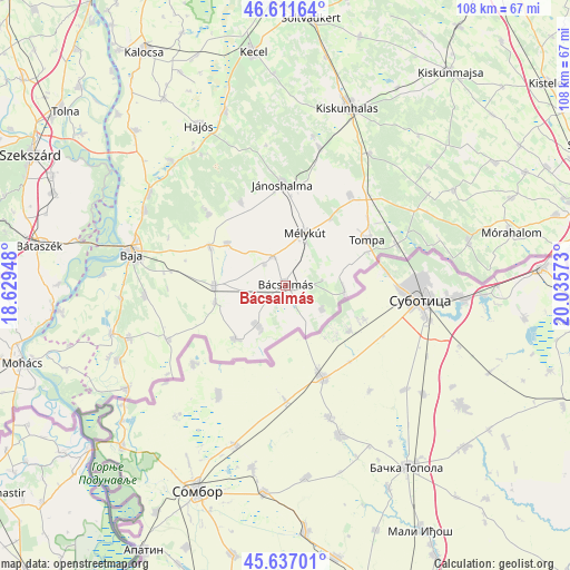
Bácsalmás GPS coordinates[2]
46° 7' 35.328" North, 19° 19' 57.36" East
| Map corner | latitude | longitude |
|---|---|---|
| Upper-left | 46.61164°, | 18.62948° |
| Center: | 46.12648°, | 19.3326° |
| Lower-right: | 45.63701°, | 20.03573° |
| Map W x H: | 108.4×108.4 km | = 67.4×67.4mi |
| max Lat: | 48.46667° ⇑97% North |
| Bácsalmás: | 46.12648° |
| min Lat: | ⇓3% South 45.79108° |
| min Long | Bácsalmás | max Long |
| 16.27358° | 19.3326° | 22.68096° |
| W 46.4%⇐ | ⇒53.6% E |
Elevation
Elevation of Bácsalmás is 123 m = 404 ft, and this is 6.7 m = 22 ft below average elevation for this country.
| Max E: |
444 m = 1457 ft | 43.2% |
| Avg. | 129.7 m = 426 ft | |
| Bácsalmás | 123 m = 404 ft | |
Min E: |
71 m = 233 ft | 56.8% |
See also: Hungary elevation on elevation.city.
Geographical zone
Bácsalmás is located in North temperate zone (between Tropic of Cancer and the Arctic Circle). Distance of this North polar circle is 2272.4 km =1412 mi to North.| Distance of | km | miles | from Bácsalmás |
|---|---|---|---|
| North Pole | 4878.3 | 3031.2 | to North |
| Arctic Circle | 2272.4 | 1412 | to North |
| Tropic Cancer | 2522.9 | 1567.7 | to South |
| Equator | 5128.8 | 3186.9 | to South |


Nearby cities:
15 places around Bácsalmás: (largest is in red/bold)
• Baja
29.9 km =18.6 mi,  282°
282°
• Bácsbokod
13.6 km =8.5 mi,  269°
269°
• Csávoly
15.9 km =9.9 mi,  295°
295°
• Felsőszentiván
13.7 km =8.5 mi, 304°
• Gara
24.7 km =15.3 mi,  244°
244°
• Jánoshalma
19.1 km =11.9 mi,  358°
358°
• Katymár
14 km =8.7 mi,  222°
222°
• Kelebia
23.2 km =14.4 mi,  70°
70°
• Kisszállás
20.9 km =13 mi,  35°
35°
• Kunfehértó
26.8 km =16.7 mi,  13°
13°
• Madaras
9.3 km =5.8 mi, 216°
• Mélykút
10.5 km =6.5 mi,  20°
20°
• Tompa
18.2 km =11.3 mi,  60°
60°
• Vaskút
26.9 km =16.7 mi, 265°
• Érsekcsanád
30.3 km =18.8 mi, 297°
Sources, notices
• [Note1] Compared only with cities in Hungary existing in our database
• [Src1] Map data: © OpenStreetMap contributors (CC-BY-SA)
• [Src2] Other city data from geonames.org with taken over terms of usage.
• [Src3] Geographical zone / Annual Mean Temperature by Robert A. Rohde @ Wikipedia
