Kiskőrös geodata
Kiskőrös (Bács-Kiskun) is a seat of a second-order administrative division; located in Hungary in Europe/Budapest (GMT+2) time zone. With population of 15,091 people, there are 112 cities with bigger population in this country. Compared to other cities in Hungary, 82.8% of cities are located further ↑North; 54.7% of cities are located further →East and 72.5% of cities have higher elevation than Kiskőrös. Note1


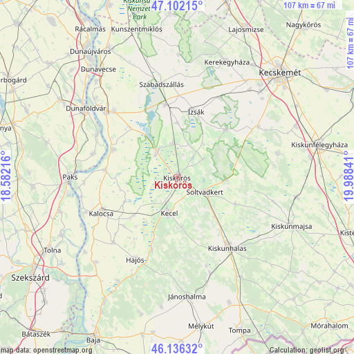
Kiskőrös GPS coordinates[2]
46° 37' 17.004" North, 19° 17' 7.008" East
| Map corner | latitude | longitude |
|---|---|---|
| Upper-left | 47.10215°, | 18.58216° |
| Center: | 46.62139°, | 19.28528° |
| Lower-right: | 46.13632°, | 19.98841° |
| Map W x H: | 107.4×107.4 km | = 66.7×66.7mi |
| max Lat: | 48.46667° ⇑82.8% North |
| Kiskőrös: | 46.62139° |
| min Lat: | ⇓17.2% South 45.79108° |
| min Long | Kiskőrös | max Long |
| 16.27358° | 19.28528° | 22.68096° |
| W 45.3%⇐ | ⇒54.7% E |
Elevation
Elevation of Kiskőrös is 100 m = 328 ft, and this is 29.7 m = 97 ft below average elevation for this country.
| Max E: |
444 m = 1457 ft | 72.5% |
| Avg. | 129.7 m = 426 ft | |
| Kiskőrös | 100 m = 328 ft | |
Min E: |
71 m = 233 ft | 27.5% |
See also: Hungary elevation on elevation.city.
Geographical zone
Kiskőrös is located in North temperate zone (between Tropic of Cancer and the Arctic Circle). Distance of this North polar circle is 2217.4 km =1377.8 mi to North.| Distance of | km | miles | from Kiskőrös |
|---|---|---|---|
| North Pole | 4823.2 | 2997 | to North |
| Arctic Circle | 2217.4 | 1377.8 | to North |
| Tropic Cancer | 2577.9 | 1601.8 | to South |
| Equator | 5183.8 | 3221.1 | to South |


Nearby cities:
15 places around Kiskőrös: (largest is in red/bold)
• Akasztó
10 km =6.2 mi,  321°
321°
• Csengőd
10.5 km =6.5 mi,  352°
352°
• Császártöltés
23.5 km =14.6 mi,  199°
199°
• Dunapataj
22.2 km =13.8 mi,  276°
276°
• Fülöpszállás
22.5 km =14 mi, 350°
• Harta
21.2 km =13.2 mi,  293°
293°
• Izsák
21 km =13 mi,  13°
13°
• Kalocsa
26 km =16.2 mi,  246°
246°
• Kecel
11 km =6.8 mi,  193°
193°
• Kiskunhalas
25.8 km =16 mi,  143°
143°
• Madocsa
26.1 km =16.2 mi, 286°
• Orgovány
20.3 km =12.6 mi,  44°
44°
• Soltvadkert
9.5 km =5.9 mi,  119°
119°
• Tázlár
19.3 km =12 mi,  114°
114°
• Ágasegyháza
27.5 km =17.1 mi,  27°
27°
Sources, notices
• [Note1] Compared only with cities in Hungary existing in our database
• [Src1] Map data: © OpenStreetMap contributors (CC-BY-SA)
• [Src2] Other city data from geonames.org with taken over terms of usage.
• [Src3] Geographical zone / Annual Mean Temperature by Robert A. Rohde @ Wikipedia
