Soltvadkert geodata
Soltvadkert (Bács-Kiskun) is a populated place; located in Hungary in Europe/Budapest (GMT+2) time zone. With population of 7,695 people, there are 203 cities with bigger population in this country. Compared to other cities in Hungary, 83.7% of cities are located further ↑North; 52.3% of cities are located further →East and 58.1% of cities have higher elevation than Soltvadkert. Note1


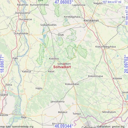
Soltvadkert GPS coordinates[2]
46° 34' 44.004" North, 19° 23' 38.004" East
| Map corner | latitude | longitude |
|---|---|---|
| Upper-left | 47.06003°, | 18.69077° |
| Center: | 46.57889°, | 19.39389° |
| Lower-right: | 46.09344°, | 20.09702° |
| Map W x H: | 107.5×107.5 km | = 66.8×66.8mi |
| max Lat: | 48.46667° ⇑83.7% North |
| Soltvadkert: | 46.57889° |
| min Lat: | ⇓16.3% South 45.79108° |
| min Long | Soltvadkert | max Long |
| 16.27358° | 19.39389° | 22.68096° |
| W 47.7%⇐ | ⇒52.3% E |
Elevation
Elevation of Soltvadkert is 111 m = 364 ft, and this is 18.7 m = 61 ft below average elevation for this country.
| Max E: |
444 m = 1457 ft | 58.1% |
| Avg. | 129.7 m = 426 ft | |
| Soltvadkert | 111 m = 364 ft | |
Min E: |
71 m = 233 ft | 41.9% |
See also: Hungary elevation on elevation.city.
Geographical zone
Soltvadkert is located in North temperate zone (between Tropic of Cancer and the Arctic Circle). Distance of this North polar circle is 2222.1 km =1380.7 mi to North.| Distance of | km | miles | from Soltvadkert |
|---|---|---|---|
| North Pole | 4828 | 3000 | to North |
| Arctic Circle | 2222.1 | 1380.7 | to North |
| Tropic Cancer | 2573.2 | 1598.9 | to South |
| Equator | 5179.1 | 3218.1 | to South |


Nearby cities:
15 places around Soltvadkert: (largest is in red/bold)
• Akasztó
19.2 km =11.9 mi,  310°
310°
• Bugac
25 km =15.5 mi,  61°
61°
• Csengőd
18 km =11.2 mi,  327°
327°
• Császártöltés
23.7 km =14.7 mi,  222°
222°
• Hajós
29 km =18 mi,  226°
226°
• Izsák
25.3 km =15.7 mi,  352°
352°
• Jászszentlászló
28.1 km =17.5 mi,  92°
92°
• Kecel
12.4 km =7.7 mi,  241°
241°
• Kiskunhalas
17.5 km =10.9 mi,  156°
156°
• Kiskunmajsa
28.2 km =17.5 mi,  110°
110°
• Kiskőrös
9.5 km =5.9 mi,  299°
299°
• Kunfehértó
24.3 km =15.1 mi,  176°
176°
• Orgovány
20 km =12.4 mi,  17°
17°
• Szank
20.6 km =12.8 mi,  96°
96°
• Tázlár
9.8 km =6.1 mi, 110°
Sources, notices
• [Note1] Compared only with cities in Hungary existing in our database
• [Src1] Map data: © OpenStreetMap contributors (CC-BY-SA)
• [Src2] Other city data from geonames.org with taken over terms of usage.
• [Src3] Geographical zone / Annual Mean Temperature by Robert A. Rohde @ Wikipedia
