Kelebia geodata
Kelebia (Bács-Kiskun) is a populated place; located in Hungary in Europe/Budapest (GMT+2) time zone. With population of 2,985 people, there are 502 cities with bigger population in this country. Compared to other cities in Hungary, 95.7% of cities are located further ↑North; 52.7% of cities are located further ←West and 63% of cities have lower elevation than Kelebia. Note1


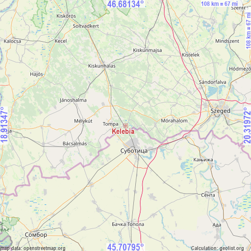
Kelebia GPS coordinates[2]
46° 11' 48.48" North, 19° 36' 59.724" East
| Map corner | latitude | longitude |
|---|---|---|
| Upper-left | 46.68134°, | 18.91347° |
| Center: | 46.1968°, | 19.61659° |
| Lower-right: | 45.70795°, | 20.31972° |
| Map W x H: | 108.2×108.2 km | = 67.2×67.2mi |
| max Lat: | 48.46667° ⇑95.7% North |
| Kelebia: | 46.1968° |
| min Lat: | ⇓4.3% South 45.79108° |
| min Long | Kelebia | max Long |
| 16.27358° | 19.61659° | 22.68096° |
| W 52.7%⇐ | ⇒47.3% E |
Elevation
Elevation of Kelebia is 129 m = 423 ft, and this is 0.69999999999999 m = 2 ft below average elevation for this country.
| Max E: |
444 m = 1457 ft | 37% |
| Avg. | 129.7 m = 426 ft | |
| Kelebia | 129 m = 423 ft | |
Min E: |
71 m = 233 ft | 63% |
See also: Hungary elevation on elevation.city.
Geographical zone
Kelebia is located in North temperate zone (between Tropic of Cancer and the Arctic Circle). Distance of this North polar circle is 2264.6 km =1407.2 mi to North.| Distance of | km | miles | from Kelebia |
|---|---|---|---|
| North Pole | 4870.5 | 3026.4 | to North |
| Arctic Circle | 2264.6 | 1407.2 | to North |
| Tropic Cancer | 2530.7 | 1572.5 | to South |
| Equator | 5136.6 | 3191.7 | to South |


Nearby cities:
15 places around Kelebia: (largest is in red/bold)
• Bordány
27.2 km =16.9 mi,  60°
60°
• Bácsalmás
23.2 km =14.4 mi,  250°
250°
• Domaszék
30.9 km =19.2 mi,  79°
79°
• Forráskút
29.3 km =18.2 mi,  50°
50°
• Jánoshalma
25.1 km =15.6 mi,  296°
296°
• Kiskunhalas
28.3 km =17.6 mi,  339°
339°
• Kisszállás
13.5 km =8.4 mi,  313°
313°
• Kunfehértó
24 km =14.9 mi,  319°
319°
• Mélykút
18.2 km =11.3 mi,  276°
276°
• Mórahalom
20.8 km =12.9 mi, 83°
• Ruzsa
14.3 km =8.9 mi,  44°
44°
• Tompa
6.1 km =3.8 mi, 279°
• Zákányszék
22.7 km =14.1 mi,  67°
67°
• Ásotthalom
12.8 km =8 mi,  89°
89°
• Üllés
23.4 km =14.5 mi, 48°
Sources, notices
• [Note1] Compared only with cities in Hungary existing in our database
• [Src1] Map data: © OpenStreetMap contributors (CC-BY-SA)
• [Src2] Other city data from geonames.org with taken over terms of usage.
• [Src3] Geographical zone / Annual Mean Temperature by Robert A. Rohde @ Wikipedia
