Balatonlelle geodata
Balatonlelle (Somogy) is a populated place; located in Hungary in Europe/Budapest (GMT+2) time zone. With population of 4,910 people, there are 302 cities with bigger population in this country. Compared to other cities in Hungary, 77.5% of cities are located further ↑North; 89.1% of cities are located further →East and 56.5% of cities have higher elevation than Balatonlelle. Note1


Balatonlelle GPS coordinates[2]
46° 46' 59.448" North, 17° 41' 41.928" East
| Map corner | latitude | longitude |
|---|---|---|
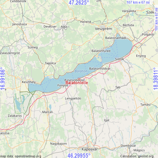
| Upper-left | 47.2625°, | 16.99186° |
| Center: | 46.78318°, | 17.69498° |
| Lower-right: | 46.29955°, | 18.39811° |
| Map W x H: | 107.1×107.1 km | = 66.5×66.5mi |
| max Lat: | 48.46667° ⇑77.5% North |
| Balatonlelle: | 46.78318° |
| min Lat: | ⇓22.5% South 45.79108° |
| min Long | Balatonlelle | max Long |
| 16.27358° | 17.69498° | 22.68096° |
| W 10.9%⇐ | ⇒89.1% E |
Elevation
Elevation of Balatonlelle is 112 m = 367 ft, and this is 17.7 m = 58 ft below average elevation for this country.
| Max E: |
444 m = 1457 ft | 56.5% |
| Avg. | 129.7 m = 426 ft | |
| Balatonlelle | 112 m = 367 ft | |
Min E: |
71 m = 233 ft | 43.5% |
See also: Hungary elevation on elevation.city.
Geographical zone
Balatonlelle is located in North temperate zone (between Tropic of Cancer and the Arctic Circle). Distance of this North polar circle is 2199.4 km =1366.6 mi to North.| Distance of | km | miles | from Balatonlelle |
|---|---|---|---|
| North Pole | 4805.3 | 2985.9 | to North |
| Arctic Circle | 2199.4 | 1366.6 | to North |
| Tropic Cancer | 2595.9 | 1613 | to South |
| Equator | 5201.8 | 3232.2 | to South |


Nearby cities:
15 places around Balatonlelle: (largest is in red/bold)
• Badacsonytomaj
14 km =8.7 mi,  280°
280°
• Balatonboglár
4 km =2.5 mi,  257°
257°
• Balatonfenyves
17.2 km =10.7 mi,  243°
243°
• Balatonföldvár
16.1 km =10 mi,  61°
61°
• Balatonfüred
24 km =14.9 mi,  34°
34°
• Balatonszárszó
11.1 km =6.9 mi, 62°
• Fonyód
9.3 km =5.8 mi,  250°
250°
• Karád
15.2 km =9.4 mi,  132°
132°
• Lengyeltóti
13.2 km =8.2 mi,  197°
197°
• Révfülöp
7.4 km =4.6 mi,  309°
309°
• Somogyvár
22.6 km =14 mi,  186°
186°
• Tapolca
22.2 km =13.8 mi,  299°
299°
• Tihany
20.7 km =12.9 mi,  45°
45°
• Zamárdi
22.7 km =14.1 mi, 60°
• Zánka
9.8 km =6.1 mi,  355°
355°
Sources, notices
• [Note1] Compared only with cities in Hungary existing in our database
• [Src1] Map data: © OpenStreetMap contributors (CC-BY-SA)
• [Src2] Other city data from geonames.org with taken over terms of usage.
• [Src3] Geographical zone / Annual Mean Temperature by Robert A. Rohde @ Wikipedia
