Karád geodata
Karád (Somogy) is a populated place; located in Hungary in Europe/Budapest (GMT+2) time zone. With population of 1,733 people, there are 852 cities with bigger population in this country. Compared to other cities in Hungary, 80.6% of cities are located further ↑North; 87.9% of cities are located further →East and 90.2% of cities have lower elevation than Karád. Note1


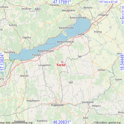
Karád GPS coordinates[2]
46° 41' 26.736" North, 17° 50' 28.896" East
| Map corner | latitude | longitude |
|---|---|---|
| Upper-left | 47.17091°, | 17.13824° |
| Center: | 46.69076°, | 17.84136° |
| Lower-right: | 46.20631°, | 18.54449° |
| Map W x H: | 107.3×107.3 km | = 66.7×66.7mi |
| max Lat: | 48.46667° ⇑80.6% North |
| Karád: | 46.69076° |
| min Lat: | ⇓19.4% South 45.79108° |
| min Long | Karád | max Long |
| 16.27358° | 17.84136° | 22.68096° |
| W 12.1%⇐ | ⇒87.9% E |
Elevation
Elevation of Karád is 190 m = 623 ft, and this is 60.3 m = 198 ft above average elevation for this country.
| Max E: |
444 m = 1457 ft | 9.8% |
| Karád | 190 m 623 ft | |
| Avg. | 129.7 m = 426 ft | |
Min E: |
71 m = 233 ft | 90.2% |
See also: Hungary elevation on elevation.city.
Geographical zone
Karád is located in North temperate zone (between Tropic of Cancer and the Arctic Circle). Distance of this North polar circle is 2209.6 km =1373 mi to North.| Distance of | km | miles | from Karád |
|---|---|---|---|
| North Pole | 4815.5 | 2992.2 | to North |
| Arctic Circle | 2209.6 | 1373 | to North |
| Tropic Cancer | 2585.6 | 1606.6 | to South |
| Equator | 5191.5 | 3225.8 | to South |


Nearby cities:
15 places around Karád: (largest is in red/bold)
• Balatonboglár
17.7 km =11 mi,  302°
302°
• Balatonfenyves
26.8 km =16.7 mi,  275°
275°
• Balatonföldvár
18.2 km =11.3 mi,  9°
9°
• Balatonlelle
15.2 km =9.4 mi,  312°
312°
• Balatonszárszó
15.5 km =9.6 mi,  355°
355°
• Fonyód
21.2 km =13.2 mi,  289°
289°
• Iregszemcse
26.3 km =16.3 mi,  89°
89°
• Lengyeltóti
15.2 km =9.4 mi,  261°
261°
• Révfülöp
22.6 km =14 mi, 311°
• Somogyvár
18.3 km =11.4 mi,  228°
228°
• Szakcs
26.5 km =16.5 mi,  129°
129°
• Tab
15.2 km =9.4 mi,  72°
72°
• Tihany
25.1 km =15.6 mi, 8°
• Zamárdi
23.2 km =14.4 mi,  21°
21°
• Zánka
23.4 km =14.5 mi,  329°
329°
Sources, notices
• [Note1] Compared only with cities in Hungary existing in our database
• [Src1] Map data: © OpenStreetMap contributors (CC-BY-SA)
• [Src2] Other city data from geonames.org with taken over terms of usage.
• [Src3] Geographical zone / Annual Mean Temperature by Robert A. Rohde @ Wikipedia
